 |
|
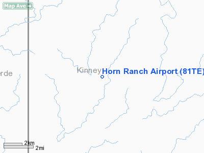
Location & QuickFacts
| FAA Information Effective: | 2008-09-25 |
| Airport Identifier: | 81TE |
| Airport Status: | Operational |
| Longitude/Latitude: | 100-37-01.3170W/29-32-30.8170N
-100.617032/29.541894 (Estimated) |
| Elevation: | 1290 ft / 393.19 m (Estimated) |
| Land: | 0 acres |
| From nearest city: | 18 nautical miles NE of Del Rio, TX |
| Location: | Kinney County, TX |
| Magnetic Variation: | 08E (1985) |
Owner & Manager
| Ownership: | Privately owned |
| Address: |
|
| Manager: | Bill Lewis |
| Address: | P O Box 1175
Del Rio, TX 78840 |
| Phone number: | 512-775-8508 |
Airport Operations and Facilities
| Airport Use: | Private |
| Wind indicator: | No |
| Segmented Circle: | No |
| Control Tower: | No |
| Landing fee charge: | No |
| Sectional chart: | San Antonio |
| Region: | ASW - Southwest |
| Boundary ARTCC: | ZHU - Houston |
| Tie-in FSS: | SJT - San Angelo |
| FSS on Airport: | No |
| FSS Toll Free: | 1-800-WX-BRIEF |
Airport Services
| Airframe Repair: | NONE |
| Power Plant Repair: | NONE |
Runway Information
Runway 02/20
| Dimension: | 2100 x 200 ft / 640.1 x 61.0 m |
| Surface: | DIRT, |
| |
Runway 02 |
Runway 20 |
| Traffic Pattern: | Left | Left |
|
Runway 13/31
| Dimension: | 1300 x 200 ft / 396.2 x 61.0 m |
| Surface: | DIRT, |
| |
Runway 13 |
Runway 31 |
| Traffic Pattern: | Left | Left |
|
Runway 15/33
| Dimension: | 2100 x 200 ft / 640.1 x 61.0 m |
| Surface: | DIRT, |
| |
Runway 15 |
Runway 33 |
| Traffic Pattern: | Left | Left |
|
Runway 17/35
| Dimension: | 1800 x 200 ft / 548.6 x 61.0 m |
| Surface: | DIRT, |
| |
Runway 17 |
Runway 35 |
| Traffic Pattern: | Left | Left |
|
Radio Navigation Aids
| ID |
Type |
Name |
Ch |
Freq |
Var |
Dist |
| BRX | NDB | La Fonda Ranch | | 269.00 | 09E | 20.0 nm |
| PFO | NDB | Spofford | | 356.00 | 08E | 25.8 nm |
| CPZ | NDB | Chaparrosa Ranch | | 385.00 | 10E | 49.7 nm |
| DLF | VORTAC | Laughlin | 091X | 114.40 | 07E | 13.6 nm |
| RSG | VORTAC | Rocksprings | 049X | 111.20 | 10E | 32.9 nm |
Remarks
Images and information placed above are from
http://www.airport-data.com/airport/81TE/
We thank them for the data!
| General Info
|
| Country |
United States
|
| State |
TEXAS
|
| FAA ID |
81TE
|
| Latitude |
29-32-30.817N
|
| Longitude |
100-37-01.317W
|
| Elevation |
1290 feet
|
| Near City |
DEL RIO
|
We don't guarantee the information is fresh and accurate. The data may
be wrong or outdated.
For more up-to-date information please refer to other sources.
|
|


