 |
|
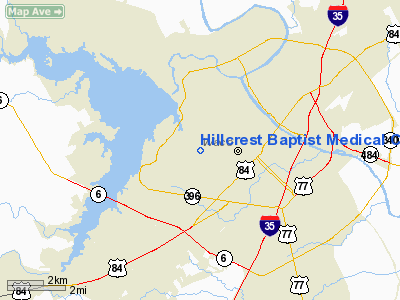
Hillcrest Baptist Medical Center Heliport |
Location & QuickFacts
| FAA Information Effective: | 2008-09-25 |
| Airport Identifier: | TA72 |
| Airport Status: | Operational |
| Longitude/Latitude: | 097-10-46.0160W/31-33-10.5970N
-97.179449/31.552944 (Estimated) |
| Elevation: | 760 ft / 231.65 m (Estimated) |
| Land: | 0 acres |
| From nearest city: | 0 nautical miles N of Waco, TX |
| Location: | Mc Lennan County, TX |
| Magnetic Variation: | 07E (1985) |
Owner & Manager
| Ownership: | Privately owned |
| Owner: | Hillcrest Baptist Med. Ctr. |
| Address: | 3000 Herring Ave.
Waco, TX 76700 |
| Phone number: | 817-756-8711 |
| Manager: | Alton Pearson, President |
| Address: | 3000 Herring Ave.
Waco, TX 76700 |
| Phone number: | 817-756-8711 |
Airport Operations and Facilities
| Airport Use: | Private
MEDICAL. |
| Wind indicator: | Yes |
| Segmented Circle: | No |
| Control Tower: | No |
| Landing fee charge: | No |
| Sectional chart: | Houston |
| Region: | ASW - Southwest |
| Boundary ARTCC: | ZFW - Fort Worth |
| Tie-in FSS: | FTW - Fort Worth |
| FSS on Airport: | No |
| FSS Phone: | 817-541-3474 |
| FSS Toll Free: | 1-800-WX-BRIEF |
Runway Information
Helipad H1
| Dimension: | 65 x 61 ft / 19.8 x 18.6 m |
| Surface: | CONC,
ROOFTOP. |
| |
Runway H1 |
Runway |
| Traffic Pattern: | Left | Left |
|
Radio Navigation Aids
| ID |
Type |
Name |
Ch |
Freq |
Var |
Dist |
| ROB | NDB | Robinson | | 400.00 | 07E | 6.4 nm |
| LXY | NDB | Mexia | | 329.00 | 07E | 34.6 nm |
| HLR | NDB | Hood | | 347.00 | 07E | 37.3 nm |
| IL | NDB | Iresh | | 278.00 | 07E | 41.8 nm |
| GR | NDB | Starn | | 323.00 | 07E | 42.7 nm |
| CGQ | NDB | Powell | | 344.00 | 06E | 49.2 nm |
| CRS | NDB | Corsicana | | 396.00 | 06E | 49.2 nm |
| MNZ | NDB | Hamilton | | 251.00 | 07E | 49.7 nm |
| TPL | VOR/DME | Temple | 041X | 110.40 | 09E | 24.2 nm |
| GNL | VOR/DME | Groesbeck | 025X | 108.80 | 05E | 32.3 nm |
| GRK | VOR/DME | Gray | 055X | 111.80 | 07E | 45.2 nm |
| ACT | VORTAC | Waco | 100X | 115.30 | 09E | 8.0 nm |
Images and information placed above are from
http://www.airport-data.com/airport/TA72/
We thank them for the data!
| General Info
|
| Country |
United States
|
| State |
TEXAS
|
| FAA ID |
TA72
|
| Latitude |
31-33-10.597N
|
| Longitude |
097-10-46.016W
|
| Elevation |
760 feet
|
| Near City |
WACO
|
We don't guarantee the information is fresh and accurate. The data may
be wrong or outdated.
For more up-to-date information please refer to other sources.
|
|


