 |
|
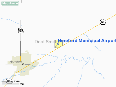
Location & QuickFacts
| FAA Information Effective: | 2008-09-25 |
| Airport Identifier: | HRX |
| Airport Status: | Operational |
| Longitude/Latitude: | 102-19-35.0903W/34-51-27.9332N
-102.326414/34.857759 (Estimated) |
| Elevation: | 3785 ft / 1153.67 m (Surveyed) |
| Land: | 601 acres |
| From nearest city: | 4 nautical miles NE of Hereford, TX |
| Location: | Deaf Smith County, TX |
| Magnetic Variation: | 09E (1995) |
Owner & Manager
| Ownership: | Publicly owned |
| Owner: | City Of Hereford |
| Address: | Box 2277
Hereford, TX 79045 |
| Phone number: | 806-363-7100 |
| Manager: | Teresa Lyons |
| Address: | 4175 Us Hwy 60
Hereford, TX 79045
HEREFORD AVIATION. |
| Phone number: | 806-258-7289 |
Airport Operations and Facilities
| Airport Use: | Open to public |
| Wind indicator: | Yes |
| Segmented Circle: | Yes |
| Control Tower: | No |
| Lighting Schedule: | DUSK-DAWN |
| Beacon Color: | Clear-Green (lighted land airport) |
| Landing fee charge: | No |
| Sectional chart: | Albuquerque |
| Region: | ASW - Southwest |
| Boundary ARTCC: | ZAB - Albuquerque |
| Tie-in FSS: | FTW - Fort Worth |
| FSS on Airport: | No |
| FSS Phone: | 817-541-3474 |
| FSS Toll Free: | 1-800-WX-BRIEF |
| NOTAMs Facility: | FTW (NOTAM-d service avaliable) |
| Federal Agreements: | NGY |
Airport Communications
| CTAF: | 122.800 |
| Unicom: | 122.800 |
Airport Services
| Fuel available: | 100LLA
FOR FUEL AFT HRS CALL 806-344-7710. WEEKENDS CALL 806-364-0460. |
| Airframe Repair: | MAJOR |
| Power Plant Repair: | MAJOR |
| Bottled Oxygen: | NONE |
| Bulk Oxygen: | NONE |
Runway Information
Runway 03/21
| Dimension: | 5387 x 75 ft / 1642.0 x 22.9 m |
| Surface: | ASPH, Fair Condition |
| Weight Limit: | Single wheel: 18000 lbs. |
| Edge Lights: | Medium |
| |
Runway 03 |
Runway 21 |
| Longitude: | 102-19-54.0186W | 102-19-16.1593W |
| Latitude: | 34-51-06.3472N | 34-51-49.5184N |
| Elevation: | 3781.00 ft | 3783.00 ft |
| Alignment: | 36 | 127 |
| Traffic Pattern: | Left | Left |
| Markings: | Non-precision instrument, Fair Condition | Non-precision instrument, Fair Condition |
| Crossing Height: | 40.00 ft | 0.00 ft |
| VASI: | 4-light PAPI on left side
PAPI OTS INDEFLY. | |
| Visual Glide Angle: | 3.50° | 0.00° |
| Obstruction: | 40 ft pline, 1200.0 ft from runway, 325 ft left of centerline, 25:1 slope to clear | , 50:1 slope to clear |
|
Runway 14/32
| Dimension: | 3880 x 135 ft / 1182.6 x 41.1 m |
| Surface: | TURF, Good Condition |
| |
Runway 14 |
Runway 32 |
| Longitude: | 102-19-52.7230W | 102-19-30.7220W |
| Latitude: | 34-51-43.2180N | 34-51-10.2190N |
| Elevation: | 3783.00 ft | 0.00 ft |
| Alignment: | 127 | 127 |
| Traffic Pattern: | Left | Left |
| Obstruction: | 45 ft pline, 1200.0 ft from runway, 245 ft right of centerline, 26:1 slope to clear | 27 ft tree, 597.0 ft from runway, 188 ft right of centerline, 22:1 slope to clear |
|
Radio Navigation Aids
| ID |
Type |
Name |
Ch |
Freq |
Var |
Dist |
| HRX | NDB | Hereford | | 341.00 | 09E | 0.1 nm |
| AM | NDB | Pande | | 251.00 | 09E | 31.0 nm |
| TXO | VORTAC | Texico | 059X | 112.20 | 11E | 33.4 nm |
| PNH | VORTAC | Panhandle | 113X | 116.60 | 08E | 38.3 nm |
Remarks
Images and information placed above are from
http://www.airport-data.com/airport/HRX/
We thank them for the data!
| General Info
|
| Country |
United States
|
| State |
TEXAS
|
| FAA ID |
HRX
|
| Latitude |
34-51-27.419N
|
| Longitude |
102-19-37.926W
|
| Elevation |
3783 feet
|
| Near City |
HEREFORD
|
We don't guarantee the information is fresh and accurate. The data may
be wrong or outdated.
For more up-to-date information please refer to other sources.
|
|


