 |
|
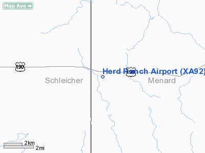
Location & QuickFacts
| FAA Information Effective: | 2008-09-25 |
| Airport Identifier: | XA92 |
| Airport Status: | Operational |
| Longitude/Latitude: | 100-06-10.0000W/30-52-12.0000N
-100.102778/30.870000 (Estimated) |
| Elevation: | 2185 ft / 665.99 m (Estimated) |
| Land: | 60 acres |
| From nearest city: | 17 nautical miles W of Menard, TX |
| Location: | Menard County, TX |
| Magnetic Variation: | () |
Owner & Manager
| Ownership: | Privately owned |
| Owner: | Herd Ranch |
| Address: | Po Box 130
Midland, TX 79702 |
| Phone number: | 432-684-5591 |
| Manager: | J. T. Herd |
| Address: | Po Box 130
Midland, TX 79702 |
| Phone number: | 432-684-5591 |
Airport Operations and Facilities
| Airport Use: | Private |
| Wind indicator: | Yes |
| Control Tower: | No |
| Sectional chart: | San Antonio |
| Region: | ASW - Southwest |
| Boundary ARTCC: | ZHU - Houston |
| Tie-in FSS: | SJT - San Angelo |
| FSS Toll Free: | 1-800-WX-BRIEF |
Airport Communications
Runway Information
Runway 18/36
| Dimension: | 3000 x 50 ft / 914.4 x 15.2 m |
| Surface: | TURF-DIRT, Good Condition |
| |
Runway 18 |
Runway 36 |
| Traffic Pattern: | Left | Left |
| Obstruction: | 22 ft pline, 500.0 ft from runway | |
|
Radio Navigation Aids
| ID |
Type |
Name |
Ch |
Freq |
Var |
Dist |
| SOA | NDB | Sonora | | 371.00 | 08E | 33.0 nm |
| BBD | NDB | Brady | | 380.00 | 07E | 44.2 nm |
| UBC | NDB | Ballinger | | 239.00 | 08E | 49.2 nm |
| JCT | VORTAC | Junction | 107X | 116.00 | 08E | 22.0 nm |
| SJT | VORTAC | San Angelo | 098X | 115.10 | 10E | 35.3 nm |
Remarks
- PRVDD VFR; AND TELEPHONE WIRES NORTH END MKD.
Images and information placed above are from
http://www.airport-data.com/airport/XA92/
We thank them for the data!
|
|


