 |
|
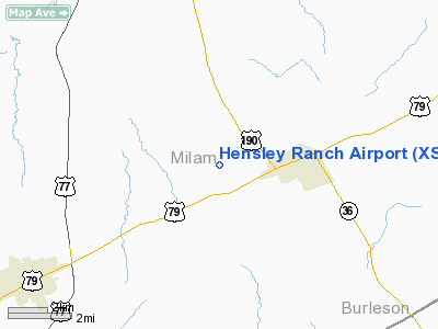
Location & QuickFacts
| FAA Information Effective: | 2008-09-25 |
| Airport Identifier: | XS17 |
| Airport Status: | Operational |
| Longitude/Latitude: | 096-54-06.9350W/30-42-32.7020N
-96.901926/30.709084 (Estimated) |
| Elevation: | 460 ft / 140.21 m (Estimated) |
| Land: | 0 acres |
| From nearest city: | 3 nautical miles W of Milano, TX |
| Location: | Cameron County, TX |
| Magnetic Variation: | 06E (1985) |
Owner & Manager
| Ownership: | Privately owned |
| Owner: | Lynn C Hensley |
| Address: | 1614 W. Cameron
Rockdale, TX 76567 |
| Phone number: | 512-446-5864 |
| Address: |
|
Airport Operations and Facilities
| Airport Use: | Private |
| Wind indicator: | No |
| Segmented Circle: | No |
| Control Tower: | No |
| Landing fee charge: | No |
| Sectional chart: | Houston |
| Region: | ASW - Southwest |
| Boundary ARTCC: | ZHU - Houston |
| Tie-in FSS: | CXO - Montgomery County |
| FSS on Airport: | No |
| FSS Toll Free: | 1-800-WX-BRIEF
FOR FP FILING CALL CXO FSS 1-800-833-5602. |
Airport Services
| Airframe Repair: | NONE |
| Power Plant Repair: | NONE |
Runway Information
Runway 17/35
| Dimension: | 3500 x 150 ft / 1066.8 x 45.7 m |
| Surface: | TURF, |
| |
Runway 17 |
Runway 35 |
| Traffic Pattern: | Left | Left |
|
Radio Navigation Aids
| ID |
Type |
Name |
Ch |
Freq |
Var |
Dist |
| GYB | NDB | Lee County | | 385.00 | 07E | 32.7 nm |
| BNH | NDB | Brenham | | 362.00 | 06E | 40.1 nm |
| GUO | NDB | Georgetown | | 332.00 | 06E | 40.2 nm |
| IL | NDB | Iresh | | 278.00 | 07E | 45.7 nm |
| ROB | NDB | Robinson | | 400.00 | 07E | 48.5 nm |
| HLR | NDB | Hood | | 347.00 | 07E | 48.8 nm |
| TPL | VOR/DME | Temple | 041X | 110.40 | 09E | 40.4 nm |
| CLL | VORTAC | College Station | 080X | 113.30 | 08E | 25.7 nm |
| CWK | VORTAC | Centex | 075X | 112.80 | 06E | 38.1 nm |
| IDU | VORTAC | Industry | 039X | 110.20 | 08E | 48.6 nm |
Remarks
- RWY 17/35 HEAVY GRASS AND NO REGULARLY MAINTAINED.
- VFR ONLY.
Images and information placed above are from
http://www.airport-data.com/airport/XS17/
We thank them for the data!
| General Info
|
| Country |
United States
|
| State |
TEXAS
|
| FAA ID |
XS17
|
| Latitude |
30-42-32.702N
|
| Longitude |
096-54-06.935W
|
| Elevation |
460 feet
|
| Near City |
MILANO
|
We don't guarantee the information is fresh and accurate. The data may
be wrong or outdated.
For more up-to-date information please refer to other sources.
|
|


