 |
|
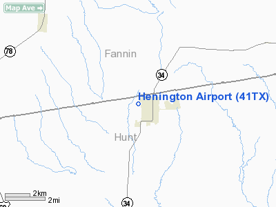
Location & QuickFacts
| FAA Information Effective: | 2008-09-25 |
| Airport Identifier: | 41TX |
| Airport Status: | Operational |
| Longitude/Latitude: | 096-04-55.9000W/33-22-29.3940N
-96.082194/33.374832 (Estimated) |
| Elevation: | 645 ft / 196.60 m (Estimated) |
| Land: | 0 acres |
| From nearest city: | 1 nautical miles NW of Wolfe City, TX |
| Location: | Hunt County, TX |
| Magnetic Variation: | 06E (1985) |
Owner & Manager
| Ownership: | Privately owned |
| Owner: | Henington Industries |
| Address: | Drawer J
Wolfe City, TX 75496 |
| Phone number: | 214-496-2231 |
| Manager: | R. H. Wensel |
| Address: | Box 29
Wolfe City, TX 75496 |
| Phone number: | 903-496-2226 |
Airport Operations and Facilities
| Airport Use: | Private |
| Wind indicator: | Yes |
| Segmented Circle: | No |
| Control Tower: | No |
| Landing fee charge: | No |
| Sectional chart: | Dallas-ft Worth |
| Region: | ASW - Southwest |
| Boundary ARTCC: | ZFW - Fort Worth |
| Tie-in FSS: | FTW - Fort Worth |
| FSS on Airport: | No |
| FSS Phone: | 817-541-3474 |
| FSS Toll Free: | 1-800-WX-BRIEF |
Airport Services
| Airframe Repair: | NONE |
| Power Plant Repair: | NONE |
Runway Information
Runway 13/31
| Dimension: | 2800 x 30 ft / 853.4 x 9.1 m |
| Surface: | TRTD-DIRT, |
| |
Runway 13 |
Runway 31 |
| Traffic Pattern: | Left | Left |
| VASI: | non-specific system | |
|
Radio Navigation Aids
| ID |
Type |
Name |
Ch |
Freq |
Var |
Dist |
| HJM | NDB | Rayburn | | 415.00 | 06E | 15.1 nm |
| MII | NDB | Caddo Mills | | 316.00 | 06E | 21.8 nm |
| SYW | NDB | Cash | | 428.00 | 05E | 23.6 nm |
| DUA | NDB | Durant | | 359.00 | 05E | 37.6 nm |
| AVZ | NDB | Travis | | 260.00 | 06E | 37.9 nm |
| DNI | NDB | Denison | | 341.00 | 06E | 39.9 nm |
| PQF | NDB | Mesquite | | 248.00 | 06E | 40.8 nm |
| JUG | NDB | Jecca | | 388.00 | 06E | 48.2 nm |
| HHW | NDB | Hugo | | 323.00 | 05E | 48.3 nm |
| MJF | TACAN | Arvilla | 033X | | 05E | 18.6 nm |
| SLR | VOR/DME | Sulphur Springs | 027X | 109.00 | 08E | 29.1 nm |
| PRX | VOR/DME | Paris | 083X | 113.60 | 07E | 33.3 nm |
| URH | VOR/DME | Texoma | 090X | 114.30 | 05E | 37.6 nm |
| UIM | VOR/DME | Quitman | 087X | 114.00 | 08E | 46.7 nm |
| BYP | VORTAC | Bonham | 093X | 114.60 | 06E | 12.4 nm |
Remarks
- PRESUMED TO PRE DATE THE ACT.
Images and information placed above are from
http://www.airport-data.com/airport/41TX/
We thank them for the data!
| General Info
|
| Country |
United States
|
| State |
TEXAS
|
| FAA ID |
41TX
|
| Latitude |
33-22-29.394N
|
| Longitude |
096-04-55.900W
|
| Elevation |
645 feet
|
| Near City |
WOLFE CITY
|
We don't guarantee the information is fresh and accurate. The data may
be wrong or outdated.
For more up-to-date information please refer to other sources.
|
|


