 |
|
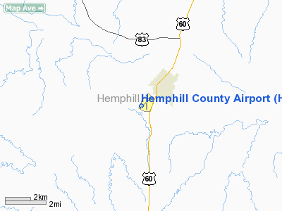
Location & QuickFacts
| FAA Information Effective: | 2008-09-25 |
| Airport Identifier: | HHF |
| Airport Status: | Operational |
| Longitude/Latitude: | 100-24-13.9536W/35-53-42.4373N
-100.403876/35.895121 (Estimated) |
| Elevation: | 2394 ft / 729.69 m (Surveyed) |
| Land: | 168 acres |
| From nearest city: | 2 nautical miles SW of Canadian, TX |
| Location: | Hemphill County, TX |
| Magnetic Variation: | 08E (1995) |
Owner & Manager
| Ownership: | Publicly owned |
| Owner: | Hemphill County |
| Address: | Po Box 536
Canadian, TX 79014 |
| Phone number: | 806-323-8087 |
| Manager: | Charles L Kessie |
| Address: | 209 Main
Canadian, TX 79014 |
| Phone number: | 806-323-6542 |
Airport Operations and Facilities
| Airport Use: | Open to public |
| Wind indicator: | Yes
WINDSOCK LGTS OTS INDEFLY. |
| Segmented Circle: | Yes |
| Control Tower: | No |
| Lighting Schedule: | DUSK-DAWN
MIRL RY 04/22 PRESET LOW INTST; TO INCR INTST ACTVT - CTAF. |
| Beacon Color: | Clear-Green (lighted land airport) |
| Landing fee charge: | No |
| Sectional chart: | Dallas-ft Worth |
| Region: | ASW - Southwest |
| Traffic Pattern Alt: | 1000 ft |
| Boundary ARTCC: | ZAB - Albuquerque |
| Tie-in FSS: | FTW - Fort Worth |
| FSS on Airport: | No |
| FSS Phone: | 817-541-3474 |
| FSS Toll Free: | 1-800-WX-BRIEF |
| NOTAMs Facility: | HHF (NOTAM-d service avaliable) |
| Federal Agreements: | NGY |
Airport Communications
Airport Services
| Fuel available: | 100LL
FOR FUEL CALL 806-323-5324. |
| Bottled Oxygen: | NONE |
| Bulk Oxygen: | NONE |
Runway Information
Runway 04/22
| Dimension: | 5000 x 75 ft / 1524.0 x 22.9 m |
| Surface: | ASPH, Good Condition |
| Weight Limit: | Single wheel: 12500 lbs. |
| Edge Lights: | Medium |
| |
Runway 04 |
Runway 22 |
| Longitude: | 100-24-37.0900W | 100-23-54.5900W |
| Latitude: | 35-53-24.5200N | 35-53-59.8600N |
| Elevation: | 2384.00 ft | 2373.00 ft |
| Alignment: | 44 | 127 |
| Traffic Pattern: | Left | Right |
| Markings: | Non-precision instrument, Fair Condition | Non-precision instrument, Fair Condition |
| Crossing Height: | 38.00 ft | 35.00 ft |
| VASI: | 2-light PAPI on left side | 2-light PAPI on left side |
| Visual Glide Angle: | 3.00° | 3.00° |
| Runway End Identifier: | Yes | Yes |
| Obstruction: | 4 ft fence, 300.0 ft from runway, 25:1 slope to clear | 4 ft hill, 300.0 ft from runway, 40 ft left of centerline, 25:1 slope to clear |
|
Runway 18/36
| Dimension: | 3000 x 30 ft / 914.4 x 9.1 m |
| Surface: | ASPH, Good Condition |
| Weight Limit: | Single wheel: 12500 lbs. |
| |
Runway 18 |
Runway 36 |
| Longitude: | 100-24-09.1360W | 100-24-12.4830W |
| Latitude: | 35-53-57.6190N | 35-53-28.0800N |
| Elevation: | 2365.00 ft | 2394.00 ft |
| Alignment: | 127 | 5 |
| Traffic Pattern: | Right | Left |
| Markings: | Basic, Good Condition | Basic, Good Condition |
| Displaced threshold: | 100.00 ft | 0.00 ft |
| Obstruction: | 30 ft trees, 274.0 ft from runway, 125 ft right of centerline, 2:1 slope to clear
RY 18 APCH SLOPE 12:1 AT DSPLCD THLD.
+2 FT HILL 67 FT LEFT AT THLD. | 26 ft tree, 210.0 ft from runway, 47 ft right of centerline |
|
Radio Navigation Aids
| ID |
Type |
Name |
Ch |
Freq |
Var |
Dist |
| HHF | NDB | Hemphill County | | 400.00 | 08E | 0.3 nm |
| PPA | NDB | Pampa | | 368.00 | 09E | 33.3 nm |
| PYX | NDB | Perryton | | 266.00 | 09E | 35.3 nm |
| GAG | VORTAC | Gage | 103X | 115.60 | 10E | 37.1 nm |
| BGD | VORTAC | Borger | 023X | 108.60 | 11E | 48.0 nm |
Remarks
- 15 FT DITCH NORTH OF RY 04 THLD EXTENDING 1000 FT ALONG LEFT SIDE OF RY.
Images and information placed above are from
http://www.airport-data.com/airport/HHF/
We thank them for the data!
| General Info
|
| Country |
United States
|
| State |
TEXAS
|
| FAA ID |
HHF
|
| Latitude |
35-53-43.108N
|
| Longitude |
100-24-13.103W
|
| Elevation |
2394 feet
|
| Near City |
CANADIAN
|
We don't guarantee the information is fresh and accurate. The data may
be wrong or outdated.
For more up-to-date information please refer to other sources.
|
|


