 |
|
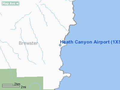
Location & QuickFacts
| FAA Information Effective: | 2008-09-25 |
| Airport Identifier: | 1XS7 |
| Airport Status: | Operational |
| Longitude/Latitude: | 102-49-54.5690W/29-27-00.7190N
-102.831825/29.450200 (Estimated) |
| Elevation: | 1857 ft / 566.01 m (Surveyed) |
| Land: | 0 acres |
| From nearest city: | 43 nautical miles NE of Terlingua, TX |
| Location: | Brewster County, TX |
| Magnetic Variation: | 09E (1985) |
Owner & Manager
| Ownership: | Privately owned |
| Owner: | Ei Dupont De Nemours & Co |
| Address: | Box 457
Marathon, TX 79842 |
| Phone number: | 915-376-2224 |
| Manager: | Jose M. Castillo |
| Address: | Po Box 457
Marathon, TX 79842 |
| Phone number: | 915-376-2224 |
Airport Operations and Facilities
| Airport Use: | Private |
| Wind indicator: | Yes |
| Segmented Circle: | No |
| Control Tower: | No |
| Landing fee charge: | No |
| Sectional chart: | San Antonio |
| Region: | ASW - Southwest |
| Boundary ARTCC: | ZAB - Albuquerque |
| Tie-in FSS: | SJT - San Angelo |
| FSS on Airport: | No |
| FSS Toll Free: | 1-800-WX-BRIEF |
Airport Communications
Airport Services
| Airframe Repair: | NONE |
| Power Plant Repair: | NONE |
Runway Information
Runway 10/28
| Dimension: | 2500 x 30 ft / 762.0 x 9.1 m |
| Surface: | ASPH, |
| |
Runway 10 |
Runway 28 |
| Traffic Pattern: | Left | Left |
|
Radio Navigation Aids
| ID |
Type |
Name |
Ch |
Freq |
Var |
Dist |
Images and information placed above are from
http://www.airport-data.com/airport/1XS7/
We thank them for the data!
| General Info
|
| Country |
United States
|
| State |
TEXAS
|
| FAA ID |
1XS7
|
| Latitude |
29-27-00.719N
|
| Longitude |
102-49-54.569W
|
| Elevation |
1857 feet
|
| Near City |
TERLINGUA
|
We don't guarantee the information is fresh and accurate. The data may
be wrong or outdated.
For more up-to-date information please refer to other sources.
|
|


