 |
|
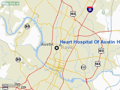
Heart Hospital Of Austin Heliport |
Location & QuickFacts
| FAA Information Effective: | 2008-09-25 |
| Airport Identifier: | XS41 |
| Airport Status: | Operational |
| Longitude/Latitude: | 097-44-29.0000W/30-18-21.7000N
-97.741389/30.306028 (Estimated) |
| Elevation: | 667 ft / 203.30 m (Estimated) |
| Land: | 0 acres |
| From nearest city: | 2 nautical miles N of Austin, TX |
| Location: | Travis County, TX |
| Magnetic Variation: | 06E (1995) |
Owner & Manager
| Ownership: | Privately owned |
| Owner: | Heart Hospital Of Austin |
| Address: | 3801 North Lamar Boulevard
Austin, TX 78756 |
| Phone number: | 512-407-7000 |
| Manager: | Dave Houghton
DIRECTOR OF ENGINEERING. |
| Address: | 3801 North Lamar Boulevard
Austin, TX 78756 |
| Phone number: | 512-407-7000 |
Airport Operations and Facilities
| Airport Use: | Private
MEDICAL. |
| Wind indicator: | Yes |
| Segmented Circle: | No |
| Control Tower: | No |
| Lighting Schedule: | RDO-CTL
ACTVT ROTG BCN - 155.340. |
| Beacon Color: | Clear-Green-Yellow (heliport) |
| Sectional chart: | San Antonio |
| Region: | ASW - Southwest |
| Boundary ARTCC: | ZHU - Houston |
| Tie-in FSS: | SJT - San Angelo |
| FSS Toll Free: | 1-800-WX-BRIEF |
Runway Information
Helipad H1
| Dimension: | 56 x 56 ft / 17.1 x 17.1 m |
| Surface: | CONC, |
| |
Runway H1 |
Runway |
| Traffic Pattern: | Left | Left |
|
Radio Navigation Aids
| ID |
Type |
Name |
Ch |
Freq |
Var |
Dist |
| GUO | NDB | Georgetown | | 332.00 | 06E | 23.0 nm |
| MFS | NDB | Horseshoe Bay Resort | | 403.00 | 07E | 34.5 nm |
| BMQ | NDB | Burnet | | 341.00 | 07E | 36.6 nm |
| GYB | NDB | Lee County | | 385.00 | 07E | 40.4 nm |
| IL | NDB | Iresh | | 278.00 | 07E | 43.2 nm |
| HLR | NDB | Hood | | 347.00 | 07E | 49.5 nm |
| GRK | VOR/DME | Gray | 055X | 111.80 | 07E | 43.8 nm |
| CWK | VORTAC | Centex | 075X | 112.80 | 06E | 11.8 nm |
Images and information placed above are from
http://www.airport-data.com/airport/XS41/
We thank them for the data!
| General Info
|
| Country |
United States
|
| State |
TEXAS
|
| FAA ID |
XS41
|
| Latitude |
30-18-21.700N
|
| Longitude |
097-44-29.000W
|
| Elevation |
667 feet
|
| Near City |
AUSTIN
|
We don't guarantee the information is fresh and accurate. The data may
be wrong or outdated.
For more up-to-date information please refer to other sources.
|
|


