 |
|
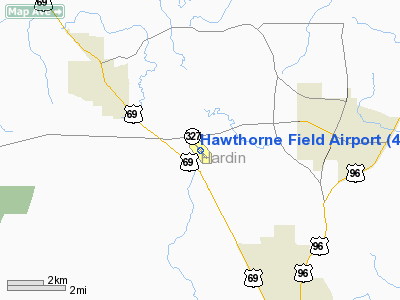
Location & QuickFacts
| FAA Information Effective: | 2008-09-25 |
| Airport Identifier: | 45R |
| Airport Status: | Operational |
| Longitude/Latitude: | 094-15-27.2000W/30-20-10.8000N
-94.257556/30.336333 (Estimated) |
| Elevation: | 165 ft / 50.29 m (Surveyed) |
| Land: | 167 acres |
| From nearest city: | 3 nautical miles SE of Kountze/silsbee, TX |
| Location: | Hardin County, TX |
| Magnetic Variation: | 04E (1995) |
Owner & Manager
| Ownership: | Publicly owned |
| Owner: | Hardin County |
| Address: | Po Box 760
Kountze, TX 77625 |
| Phone number: | 409-246-5120 |
| Manager: | Bob Burgess
COUNTY COMMISSIONER. |
| Address: | Po Box 1757
Silsbee, TX 77656 |
| Phone number: | 409-385-5501 |
Airport Operations and Facilities
| Airport Use: | Open to public |
| Wind indicator: | Yes |
| Segmented Circle: | Yes |
| Control Tower: | No |
| Lighting Schedule: | DUSK-DAWN
MIRL RY 13/31 PRESET LOW INTST; TO INCR INTST ACTVT - CTAF. |
| Beacon Color: | Clear-Green (lighted land airport) |
| Landing fee charge: | No |
| Sectional chart: | Houston |
| Region: | ASW - Southwest |
| Boundary ARTCC: | ZHU - Houston |
| Tie-in FSS: | CXO - Montgomery County |
| FSS on Airport: | No |
| FSS Toll Free: | 1-800-WX-BRIEF
FOR FP FILING CALL CXO FSS 1-800-992-7433. |
| NOTAMs Facility: | CXO (NOTAM-d service avaliable) |
| Federal Agreements: | NGYX |
Airport Communications
| CTAF: | 122.800 |
| Unicom: | 122.800 |
Airport Services
| Fuel available: | 100LL
24 HR SELF SERVE FUEL. |
Runway Information
Runway 13/31
| Dimension: | 4303 x 76 ft / 1311.6 x 23.2 m |
| Surface: | ASPH, Good Condition |
| Weight Limit: | Single wheel: 12500 lbs. |
| Edge Lights: | Medium |
| |
Runway 13 |
Runway 31 |
| Longitude: | 094-15-43.0338W | 094-15-11.2992W |
| Latitude: | 30-20-27.0381N | 30-19-54.5368N |
| Elevation: | 162.00 ft | 159.00 ft |
| Alignment: | 127 | 127 |
| Traffic Pattern: | Left | Left |
| Markings: | Non-precision instrument, Good Condition | Non-precision instrument, Good Condition |
| Crossing Height: | 29.00 ft | 31.00 ft |
| VASI: | 2-light PAPI on left side | 2-light PAPI on left side |
| Visual Glide Angle: | 3.00° | 4.00° |
| Obstruction: | 49 ft tree, 744.0 ft from runway, 225 ft right of centerline, 11:1 slope to clear | 74 ft tree, 1534.0 ft from runway, 150 ft left of centerline, 18:1 slope to clear |
|
Radio Navigation Aids
| ID |
Type |
Name |
Ch |
Freq |
Var |
Dist |
| HRD | NDB | Hardin County | | 524.00 | 04E | 0.2 nm |
| GDE | NDB | Goodhue | | 368.00 | 07E | 16.3 nm |
| ORG | NDB | Orange | | 211.00 | 05E | 28.9 nm |
| JAS | NDB | Jasper | | 344.00 | 04E | 38.9 nm |
| CBC | NDB | Anahuac | | 413.00 | 05E | 39.9 nm |
| DQU | NDB | De Quincy | | 410.00 | 05E | 41.4 nm |
| UX | NDB | Sulfy | | 278.00 | 04E | 44.2 nm |
| BPT | VOR/DME | Beaumont | 092X | 114.50 | 07E | 26.6 nm |
| SBI | VOR/DME | Sabine Pass | 101X | 115.40 | 07E | 40.7 nm |
| DAS | VORTAC | Daisetta | 116X | 116.90 | 05E | 22.0 nm |
Remarks
- SE END OF RY FLOODS DURG HVY RAINS.
Images and information placed above are from
http://www.airport-data.com/airport/45R/
We thank them for the data!
| General Info
|
| Country |
United States
|
| State |
TEXAS
|
| FAA ID |
45R
|
| Latitude |
30-20-10.817N
|
| Longitude |
094-15-27.157W
|
| Elevation |
71 feet
|
| Near City |
KOUNTZE/SILSBEE
|
We don't guarantee the information is fresh and accurate. The data may
be wrong or outdated.
For more up-to-date information please refer to other sources.
|
|


