 |
|
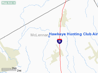
Hawkeye Hunting Club Airport |
Location & QuickFacts
| FAA Information Effective: | 2008-09-25 |
| Airport Identifier: | TX45 |
| Airport Status: | Operational |
| Longitude/Latitude: | 097-07-46.0130W/31-46-00.5820N
-97.129448/31.766828 (Estimated) |
| Elevation: | 260 ft / 79.25 m (Estimated) |
| Land: | 0 acres |
| From nearest city: | 3 nautical miles SE of Center, TX |
| Location: | Shelby County, TX |
| Magnetic Variation: | 07E (1985) |
Owner & Manager
| Ownership: | Privately owned |
| Owner: | Hawkeye Hunting Club, Inc. |
| Address: | Po Box 27
Center, TX 75935 |
| Phone number: | 409-598-2424 |
| Manager: | Jerry Waters |
| Address: | Po Box 27
Center, TX 75935 |
| Phone number: | 409-598-2424 |
Airport Operations and Facilities
| Airport Use: | Private |
| Wind indicator: | No |
| Segmented Circle: | No |
| Control Tower: | No |
| Landing fee charge: | No |
| Sectional chart: | San Antonio |
| Region: | ASW - Southwest |
| Boundary ARTCC: | ZFW - Fort Worth |
| Tie-in FSS: | CXO - Montgomery County |
| FSS on Airport: | No |
| FSS Toll Free: | 1-800-WX-BRIEF
FOR FP FILING CALL CXO FSS 1-800-833-5602. |
Airport Services
| Airframe Repair: | NONE |
| Power Plant Repair: | NONE |
Runway Information
Runway E/W
| Dimension: | 3200 x 50 ft / 975.4 x 15.2 m |
| Surface: | TURF, |
| |
Runway E |
Runway W |
| Traffic Pattern: | Left | Left |
|
Radio Navigation Aids
| ID |
Type |
Name |
Ch |
Freq |
Var |
Dist |
| ROB | NDB | Robinson | | 400.00 | 07E | 16.1 nm |
| LXY | NDB | Mexia | | 329.00 | 07E | 32.5 nm |
| CGQ | NDB | Powell | | 344.00 | 06E | 40.0 nm |
| CRS | NDB | Corsicana | | 396.00 | 06E | 40.6 nm |
| PYF | NDB | Pyramid | | 418.00 | 06E | 47.9 nm |
| HLR | NDB | Hood | | 347.00 | 07E | 48.6 nm |
| GNL | VOR/DME | Groesbeck | 025X | 108.80 | 05E | 31.7 nm |
| TPL | VOR/DME | Temple | 041X | 110.40 | 09E | 36.8 nm |
| ACT | VORTAC | Waco | 100X | 115.30 | 09E | 9.5 nm |
| JEN | VORTAC | Glen Rose | 097X | 115.00 | 06E | 44.9 nm |
Remarks
Images and information placed above are from
http://www.airport-data.com/airport/TX45/
We thank them for the data!
| General Info
|
| Country |
United States
|
| State |
TEXAS
|
| FAA ID |
TX45
|
| Latitude |
31-46-00.582N
|
| Longitude |
097-07-46.013W
|
| Elevation |
260 feet
|
| Near City |
CENTER
|
We don't guarantee the information is fresh and accurate. The data may
be wrong or outdated.
For more up-to-date information please refer to other sources.
|
|


