 |
|
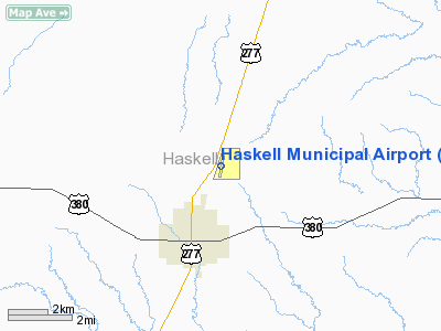
Location & QuickFacts
| FAA Information Effective: | 2008-09-25 |
| Airport Identifier: | 15F |
| Airport Status: | Operational |
| Longitude/Latitude: | 099-43-04.3415W/33-11-29.3527N
-99.717873/33.191487 (Estimated) |
| Elevation: | 1625 ft / 495.30 m (Surveyed) |
| Land: | 137 acres |
| From nearest city: | 2 nautical miles N of Haskell, TX |
| Location: | Haskell County, TX |
| Magnetic Variation: | 08E (1990) |
Owner & Manager
| Ownership: | Publicly owned |
| Owner: | City Of Haskell |
| Address: | City Hall Po Box 1003
Haskell, TX 79521 |
| Phone number: | 940-864-2333 |
| Manager: | Thomas Rodriguez
DIRECTOR OF PUBLIC WORKS. |
| Address: | Po Box 1003
Haskell, TX 79521 |
| Phone number: | 940-864-2333 |
Airport Operations and Facilities
| Airport Use: | Open to public |
| Wind indicator: | Yes |
| Segmented Circle: | Yes |
| Control Tower: | No |
| Lighting Schedule: | DUSK-DAWN
ACTVT MIRL RWY 18/36 - 122.8. |
| Beacon Color: | Clear-Green (lighted land airport) |
| Landing fee charge: | No |
| Sectional chart: | Dallas-ft Worth |
| Region: | ASW - Southwest |
| Boundary ARTCC: | ZFW - Fort Worth |
| Tie-in FSS: | FTW - Fort Worth |
| FSS on Airport: | No |
| FSS Phone: | 817-541-3474 |
| FSS Toll Free: | 1-800-WX-BRIEF |
| NOTAMs Facility: | FTW (NOTAM-d service avaliable) |
| Federal Agreements: | NGY |
Airport Communications
Airport Services
| Fuel available: | 100LL
FOR FUEL WKDAYS 0800-1700 CALL 940-864-2355; NIGHTS & WKENDS CALL 940-864-2345. |
| Bottled Oxygen: | NONE |
| Bulk Oxygen: | NONE |
Runway Information
Runway 18/36
| Dimension: | 3420 x 50 ft / 1042.4 x 15.2 m |
| Surface: | ASPH, Good Condition |
| Weight Limit: | Single wheel: 13000 lbs. |
| Edge Lights: | Non-standard lighting system
NSTD MIRL; NO AMBER LGTS. |
| |
Runway 18 |
Runway 36 |
| Longitude: | 099-43-01.6078W | 099-43-07.0749W |
| Latitude: | 33-11-46.1129N | 33-11-12.5925N |
| Elevation: | 1589.00 ft | 1625.00 ft |
| Alignment: | 127 | 8 |
| Traffic Pattern: | Left | Left |
| Markings: | Non-precision instrument, Good Condition | Non-precision instrument, Good Condition |
| Displaced threshold: | 206.00 ft | 0.00 ft |
| Obstruction: | 40 ft pline, 1000.0 ft from runway, 370 ft right of centerline, 20:1 slope to clear
APCH RATIO 30:1 TO DSPLCD THLD. | 15 ft road, 500.0 ft from runway, 20:1 slope to clear |
|
Radio Navigation Aids
| ID |
Type |
Name |
Ch |
Freq |
Var |
Dist |
| AKL | NDB | Haskell | | 407.00 | 08E | 0.1 nm |
| TMV | NDB | Stamford | | 290.00 | 08E | 19.4 nm |
| ONY | NDB | Olney | | 272.00 | 07E | 46.3 nm |
| BKD | NDB | Breckenridge | | 245.00 | 07E | 49.5 nm |
| DYS | TACAN | Dyess | 063X | | 08E | 47.0 nm |
| ABI | VORTAC | Abilene | 084X | 113.70 | 10E | 43.3 nm |
| GTH | VORTAC | Guthrie | 092X | 114.50 | 10E | 47.0 nm |
Images and information placed above are from
http://www.airport-data.com/airport/15F/
We thank them for the data!
| General Info
|
| Country |
United States
|
| State |
TEXAS
|
| FAA ID |
15F
|
| Latitude |
33-11-29.600N
|
| Longitude |
099-43-04.550W
|
| Elevation |
1624 feet
|
| Near City |
HASKELL
|
We don't guarantee the information is fresh and accurate. The data may
be wrong or outdated.
For more up-to-date information please refer to other sources.
|
|


