 |
|
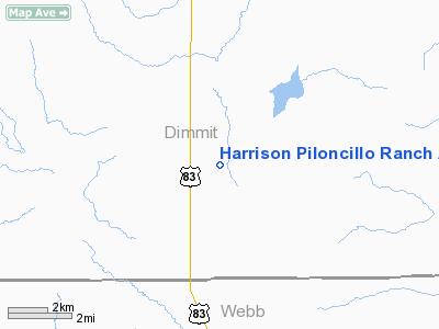
Harrison Piloncillo Ranch Airport |
Location & QuickFacts
| FAA Information Effective: | 2008-09-25 |
| Airport Identifier: | TE27 |
| Airport Status: | Operational |
| Longitude/Latitude: | 099-35-57.1590W/28-15-15.9850N
-99.599211/28.254440 (Estimated) |
| Elevation: | 520 ft / 158.50 m (Estimated) |
| Land: | 0 acres |
| From nearest city: | 4 nautical miles S of Catarina, TX |
| Location: | Dimmit County, TX |
| Magnetic Variation: | 08E (1985) |
Owner & Manager
| Ownership: | Privately owned |
| Owner: | Harrison Interests, Ltd. |
| Address: | Tx Cmce Bk Bldg, 707 Travis
Houston, TX 77002-3299
SUITE 1900. |
| Phone number: | 713-961-3900 |
| Address: |
|
Airport Operations and Facilities
| Airport Use: | Private |
| Segmented Circle: | No |
| Control Tower: | No |
| Sectional chart: | San Antonio |
| Region: | ASW - Southwest |
| Boundary ARTCC: | ZHU - Houston |
| Tie-in FSS: | SJT - San Angelo |
| FSS Toll Free: | 1-800-WX-BRIEF |
Runway Information
Runway 16/34
| Dimension: | 5000 x 60 ft / 1524.0 x 18.3 m |
| Surface: | ASPH, |
| |
Runway 16 |
Runway 34 |
| Traffic Pattern: | Left | Left |
|
Radio Navigation Aids
| ID |
Type |
Name |
Ch |
Freq |
Var |
Dist |
| DMD | NDB | Dimmit County | | 343.00 | 07E | 20.1 nm |
| LKX | NDB | La Pryor | | 223.00 | 09E | 42.8 nm |
| CPZ | NDB | Chaparrosa Ranch | | 385.00 | 10E | 44.9 nm |
| NLD | VOR/DME | Nuevo Laredo | 073X | 112.60 | 09E | 49.4 nm |
| COT | VORTAC | Cotulla | 105X | 115.80 | 09E | 28.3 nm |
| LRD | VORTAC | Laredo | 121X | 117.40 | 09E | 47.6 nm |
Images and information placed above are from
http://www.airport-data.com/airport/TE27/
We thank them for the data!
| General Info
|
| Country |
United States
|
| State |
TEXAS
|
| FAA ID |
TE27
|
| Latitude |
28-15-15.985N
|
| Longitude |
099-35-57.159W
|
| Elevation |
520 feet
|
| Near City |
CATARINA
|
We don't guarantee the information is fresh and accurate. The data may
be wrong or outdated.
For more up-to-date information please refer to other sources.
|
|


