 |
|
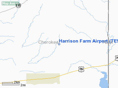
Location & QuickFacts
| FAA Information Effective: | 2008-09-25 |
| Airport Identifier: | TE91 |
| Airport Status: | Operational |
| Longitude/Latitude: | 095-04-58.0000W/32-02-21.5900N
-95.082778/32.039331 (Estimated) |
| Elevation: | 445 ft / 135.64 m (Estimated) |
| Land: | 5 acres |
| From nearest city: | 6 nautical miles SE of Troup, TX |
| Location: | Cherokee County, TX |
| Magnetic Variation: | 04E (2000) |
Owner & Manager
| Ownership: | Privately owned |
| Owner: | W.r. Harrison |
| Address: | 627 Chipper Court
Grand Prairie, TX 75052 |
| Phone number: | 972-642-1970 |
| Manager: | W.r. Harrison |
| Address: | 627 Chipper Court
Grand Prairie, TX 75052 |
| Phone number: | 972-642-1970 |
Airport Operations and Facilities
| Airport Use: | Private |
| Wind indicator: | Yes |
| Segmented Circle: | No |
| Control Tower: | No |
| Sectional chart: | Dallas-ft Worth |
| Region: | ASW - Southwest |
| Boundary ARTCC: | ZFW - Fort Worth |
| Tie-in FSS: | FTW - Fort Worth |
| FSS Phone: | 817-541-3474 |
| FSS Toll Free: | 1-800-WX-BRIEF |
Runway Information
Runway 15/33
| Dimension: | 2300 x 100 ft / 701.0 x 30.5 m |
| Surface: | TURF, |
| |
Runway 15 |
Runway 33 |
| Traffic Pattern: | Left | Left |
|
Radio Navigation Aids
| ID |
Type |
Name |
Ch |
Freq |
Var |
Dist |
| JSO | NDB | Cherokee County | | 263.00 | 05E | 12.2 nm |
| HNO | NDB | Henderson | | 371.00 | 06E | 14.4 nm |
| TY | NDB | Tyler | | 320.00 | 06E | 30.0 nm |
| GXD | NDB | Nacogdoches | | 391.00 | 05E | 30.4 nm |
| ABG | NDB | Ambassador | | 404.00 | 07E | 32.9 nm |
| PSN | NDB | Palestine | | 375.00 | 04E | 35.2 nm |
| OC | NDB | Nados | | 253.00 | 05E | 38.1 nm |
| AHX | NDB | Athens | | 269.00 | 06E | 38.7 nm |
| RPF | NDB | Carthage | | 332.00 | 04E | 40.9 nm |
| LIQ | NDB | Lochridge Ranch | | 335.00 | 09E | 44.4 nm |
| CSZ | NDB | Crossroads | | 215.00 | 08E | 44.6 nm |
| CZJ | NDB | Amason | | 341.00 | 04E | 49.0 nm |
| FZT | VOR/DME | Frankston | 051X | 111.40 | 06E | 22.9 nm |
| TYR | VOR/DME | Tyler | 089X | 114.20 | 06E | 25.1 nm |
| GGG | VORTAC | Gregg County | 070X | 112.30 | 07E | 28.3 nm |
Remarks
Images and information placed above are from
http://www.airport-data.com/airport/TE91/
We thank them for the data!
| General Info
|
| Country |
United States
|
| State |
TEXAS
|
| FAA ID |
TE91
|
| Latitude |
32-02-21.590N
|
| Longitude |
095-04-58.000W
|
| Elevation |
445 feet
|
| Near City |
TROUP
|
We don't guarantee the information is fresh and accurate. The data may
be wrong or outdated.
For more up-to-date information please refer to other sources.
|
|


