|
|
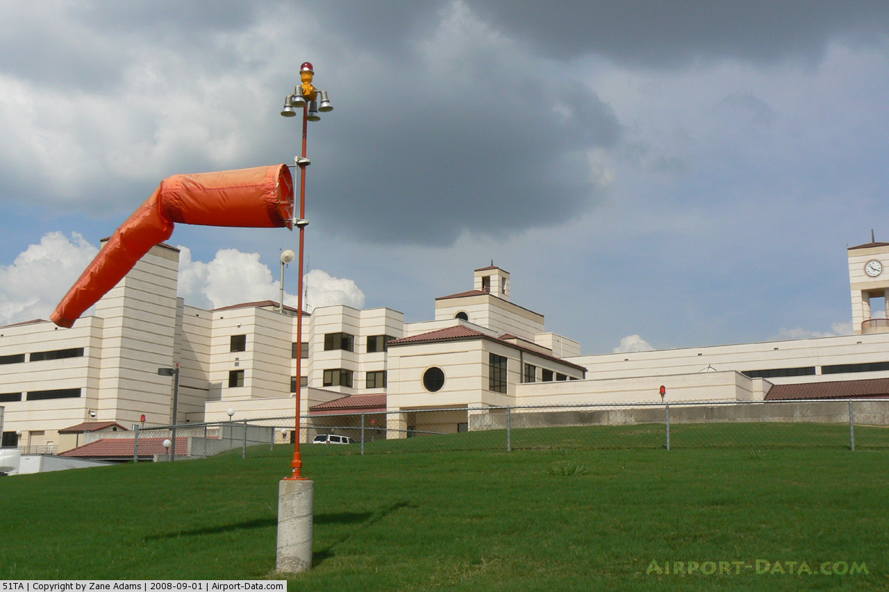
Harris Methodist Southwest Helistop Heliport |
 |
(Click on the photo to enlarge) |
 |
(Click on the photo to enlarge) |
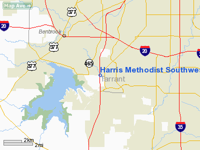
Location & QuickFacts
| FAA Information Effective: | 2008-09-25 |
| Airport Identifier: | 51TA |
| Airport Status: | Operational |
| Longitude/Latitude: | 097-24-53.0670W/32-38-43.4810N
-97.414741/32.645411 (Estimated) |
| Elevation: | 744 ft / 226.77 m (Estimated) |
| Land: | 0 acres |
| From nearest city: | 0 nautical miles N of Fort Worth, TX |
| Location: | Tarrant County, TX |
| Magnetic Variation: | 07E (1985) |
Owner & Manager
| Ownership: | Privately owned |
| Owner: | Harris Methodist Fort Worth |
| Address: | 6100 Harris Parkway
Fort Worth, TX 76132 |
| Phone number: | 817-346-5059 |
| Address: |
|
Airport Operations and Facilities
| Airport Use: | Private
MEDICAL. |
| Wind indicator: | Yes |
| Segmented Circle: | No |
| Control Tower: | No |
| Lighting Schedule: | PHONE REQ
FOR PERIMETER & FLOOD LGTS CALL 817-346-5059. |
| Sectional chart: | Dallas-ft Worth |
| Region: | ASW - Southwest |
| Boundary ARTCC: | ZFW - Fort Worth |
| Tie-in FSS: | FTW - Fort Worth |
| FSS on Airport: | No |
| FSS Phone: | 817-541-3474 |
| FSS Toll Free: | 1-800-WX-BRIEF |
Runway Information
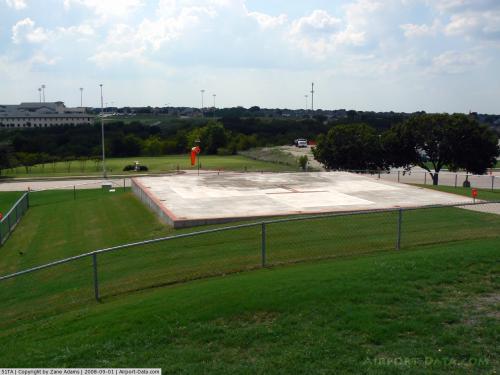
Helipad H1
| Dimension: | 40 x 40 ft / 12.2 x 12.2 m |
| Surface: | CONC, |
| |
Runway H1 |
Runway |
| Traffic Pattern: | Left | Left |
|
Radio Navigation Aids
| ID |
Type |
Name |
Ch |
Freq |
Var |
Dist |
| XQH | NDB | Cedar Hill | | 353.00 | 08E | 22.4 nm |
| RBD | NDB | Redbird | | 287.00 | 06E | 27.6 nm |
| MWL | NDB | Mineral Wells | | 266.00 | 06E | 33.6 nm |
| LNC | NDB | Lancaster | | 239.00 | 06E | 35.3 nm |
| JUG | NDB | Jecca | | 388.00 | 06E | 44.7 nm |
| PQF | NDB | Mesquite | | 248.00 | 06E | 45.9 nm |
| NFW | TACAN | Nas Jrb Fort Worth | 024X | | 07E | 7.7 nm |
| TTT | VOR/DME | Maverick | 078X | 113.10 | 06E | 23.2 nm |
| CVE | VOR/DME | Cowboy | 109X | 116.20 | 06E | 29.7 nm |
| FUZ | VORTAC | Ranger | 104X | 115.70 | 06E | 18.9 nm |
| MQP | VORTAC | Millsap | 124X | 117.70 | 09E | 29.9 nm |
| JEN | VORTAC | Glen Rose | 097X | 115.00 | 06E | 37.5 nm |
| FTW | VOT | Fort Worth Meacham | | 108.20 | | 10.7 nm |
| DAL | VOT | Dallas Love Field | | 113.30 | | 30.9 nm |
Remarks
- PRVDD VFR; TOP CORNERS OF HOSPITAL ARE MKD WITH OBSTRUCTION LGTS; ALL NEARBY LGT STOLS ARE MKD WITH OBSTRUCTION LGTS & THOSE THAT PENETRATE THE 8:1 APCH SFC ARE LOWERED TO NOT PENETRATE THIS SFC; & SIGNS ARE PLACED NEAR PAD ENTRANCE TO WARN PEDESTRIANS OF AERONAUTICAL ACTIVITY.
Images and information placed above are from
http://www.airport-data.com/airport/51TA/
We thank them for the data!
| General Info
|
| Country |
United States
|
| State |
TEXAS
|
| FAA ID |
51TA
|
| Latitude |
32-38-43.481N
|
| Longitude |
097-24-53.067W
|
| Elevation |
744 feet
|
| Near City |
FORT WORTH
|
We don't guarantee the information is fresh and accurate. The data may
be wrong or outdated.
For more up-to-date information please refer to other sources.
|
|