 |
|
Location & QuickFacts
| FAA Information Effective: | 2008-09-25 |
| Airport Identifier: | TE30 |
| Airport Status: | Operational |
| Longitude/Latitude: | 097-20-17.1600W/32-44-12.4400N
-97.338100/32.736789 (Estimated) |
| Elevation: | 753 ft / 229.51 m (Estimated) |
| Land: | 0 acres |
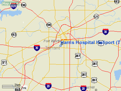
| From nearest city: | 0 nautical miles NE of Fort Worth, TX |
| Location: | Tarrant County, TX |
| Magnetic Variation: | 07E (1985) |
Owner & Manager
| Ownership: | Privately owned |
| Owner: | Harris Methodist Fort Worth |
| Address: | 1301 Pennsylvania Ave
Fort Worth, TX 76104 |
| Phone number: | 817-882-4000 |
| Manager: | Care Flite (dana Williams |
| Address: | 1301 Pennsylvania Ave
Fort Worth, TX 76104 |
| Phone number: | 817-882-4000 |
Airport Operations and Facilities
| Airport Use: | Private
MEDICAL |
| Wind indicator: | Yes |
| Segmented Circle: | No |
| Control Tower: | No |
| Lighting Schedule: | PHONE REQ
FOR LGTS CALL 817-882-4010 |
| Sectional chart: | Dallas-ft Worth |
| Region: | ASW - Southwest |
| Boundary ARTCC: | ZFW - Fort Worth |
| Tie-in FSS: | FTW - Fort Worth |
| FSS Phone: | 817-541-3474 |
| FSS Toll Free: | 1-800-WX-BRIEF |
Runway Information
Helipad H1
| Dimension: | 32 x 32 ft / 9.8 x 9.8 m |
| Surface: | ASPH,
ROOFTOP
ROOFTOP
ELEVATED CONC PAD 4'ABOVE ROOF |
| |
Runway H1 |
Runway |
| Traffic Pattern: | Left | Left |
|
Helipad H2
| Dimension: | 32 x 32 ft / 9.8 x 9.8 m |
| Surface: | ASPH,
ROOFTOP
ROOFTOP
ELEVATED CONC PAD 4'ABOVE ROOF |
| |
Runway H2 |
Runway |
| Traffic Pattern: | Left | Left |
|
Helipad H3
| Dimension: | 32 x 32 ft / 9.8 x 9.8 m |
| Surface: | ASPH,
ROOFTOP
ROOFTOP
ELEVATED CONC PAD 4'ABOVE ROOF |
| |
Runway H3 |
Runway |
| Traffic Pattern: | Left | Left |
|
Radio Navigation Aids
| ID |
Type |
Name |
Ch |
Freq |
Var |
Dist |
| XQH | NDB | Cedar Hill | | 353.00 | 08E | 20.3 nm |
| RBD | NDB | Redbird | | 287.00 | 06E | 23.9 nm |
| LNC | NDB | Lancaster | | 239.00 | 06E | 32.6 nm |
| MWL | NDB | Mineral Wells | | 266.00 | 06E | 36.5 nm |
| JUG | NDB | Jecca | | 388.00 | 06E | 41.0 nm |
| PQF | NDB | Mesquite | | 248.00 | 06E | 41.1 nm |
| NFW | TACAN | Nas Jrb Fort Worth | 024X | | 07E | 5.5 nm |
| TTT | VOR/DME | Maverick | 078X | 113.10 | 06E | 17.0 nm |
| CVE | VOR/DME | Cowboy | 109X | 116.20 | 06E | 23.8 nm |
| FUZ | VORTAC | Ranger | 104X | 115.70 | 06E | 12.2 nm |
| MQP | VORTAC | Millsap | 124X | 117.70 | 09E | 33.3 nm |
| JEN | VORTAC | Glen Rose | 097X | 115.00 | 06E | 44.2 nm |
| FTW | VOT | Fort Worth Meacham | | 108.20 | | 5.0 nm |
| DAL | VOT | Dallas Love Field | | 113.30 | | 25.5 nm |
Remarks
- PRVDD WIND CONE TO THE NORTH'S LOWERED TO LEVEL OF OBSTRUCTION LGTS; WEIGHT LIMITS FOR PADS ARE INDICATED ON UPPER RIGHT CORNER; HELIPORT IS REINSPECTED BEFORE REFUELING CAPABILITY IS ADDED
Images and information placed above are from
http://www.airport-data.com/airport/TE30/
We thank them for the data!
| General Info
|
| Country |
United States
|
| State |
TEXAS
|
| FAA ID |
TE30
|
| Latitude |
32-44-13.470N
|
| Longitude |
097-20-20.060W
|
| Elevation |
697 feet
|
| Near City |
FORT WORTH
|
We don't guarantee the information is fresh and accurate. The data may
be wrong or outdated.
For more up-to-date information please refer to other sources.
|
|


