 |
|
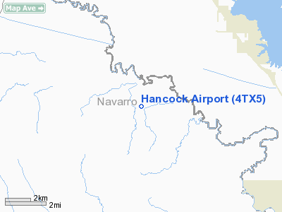
Location & QuickFacts
| FAA Information Effective: | 2008-09-25 |
| Airport Identifier: | 4TX5 |
| Airport Status: | Operational |
| Longitude/Latitude: | 096-15-34.9170W/32-13-47.5330N
-96.259699/32.229870 (Estimated) |
| Elevation: | 305 ft / 92.96 m (Estimated) |
| Land: | 0 acres |
| From nearest city: | 7 nautical miles NE of Kerens, TX |
| Location: | Navarro County, TX |
| Magnetic Variation: | 06E (1985) |
Owner & Manager
| Ownership: | Privately owned |
| Owner: | J R Hancock Trustee |
| Address: | 4713-22
Lubbock, TX 79407 |
| Address: |
|
| Phone number: | 214-396-2433 |
Airport Operations and Facilities
| Airport Use: | Private |
| Wind indicator: | Yes |
| Segmented Circle: | No |
| Control Tower: | No |
| Landing fee charge: | No |
| Sectional chart: | Dallas-ft Worth |
| Region: | ASW - Southwest |
| Boundary ARTCC: | ZFW - Fort Worth |
| Tie-in FSS: | FTW - Fort Worth |
| FSS on Airport: | No |
| FSS Phone: | 817-541-3474 |
| FSS Toll Free: | 1-800-WX-BRIEF |
Airport Services
| Airframe Repair: | NONE |
| Power Plant Repair: | NONE |
Runway Information
Runway NW/SE
| Dimension: | 3200 x 50 ft / 975.4 x 15.2 m |
| Surface: | TURF, |
| |
Runway NW |
Runway SE |
| Traffic Pattern: | Left | Left |
|
Radio Navigation Aids
| ID |
Type |
Name |
Ch |
Freq |
Var |
Dist |
| CGQ | NDB | Powell | | 344.00 | 06E | 13.1 nm |
| CRS | NDB | Corsicana | | 396.00 | 06E | 14.0 nm |
| CSZ | NDB | Crossroads | | 215.00 | 08E | 18.3 nm |
| LIQ | NDB | Lochridge Ranch | | 335.00 | 09E | 20.4 nm |
| AHX | NDB | Athens | | 269.00 | 06E | 22.3 nm |
| PYF | NDB | Pyramid | | 418.00 | 06E | 22.3 nm |
| JUG | NDB | Jecca | | 388.00 | 06E | 29.7 nm |
| LNC | NDB | Lancaster | | 239.00 | 06E | 31.4 nm |
| AVZ | NDB | Travis | | 260.00 | 06E | 31.9 nm |
| PQF | NDB | Mesquite | | 248.00 | 06E | 37.4 nm |
| LXY | NDB | Mexia | | 329.00 | 07E | 37.7 nm |
| PSN | NDB | Palestine | | 375.00 | 04E | 39.3 nm |
| RBD | NDB | Redbird | | 287.00 | 06E | 41.0 nm |
| TY | NDB | Tyler | | 320.00 | 06E | 41.7 nm |
| XQH | NDB | Cedar Hill | | 353.00 | 08E | 42.4 nm |
| SYW | NDB | Cash | | 428.00 | 05E | 46.2 nm |
| MII | NDB | Caddo Mills | | 316.00 | 06E | 48.7 nm |
| FZT | VOR/DME | Frankston | 051X | 111.40 | 06E | 38.2 nm |
| GNL | VOR/DME | Groesbeck | 025X | 108.80 | 05E | 41.7 nm |
| TYR | VOR/DME | Tyler | 089X | 114.20 | 06E | 44.2 nm |
| CQY | VORTAC | Cedar Creek | 095X | 114.80 | 06E | 3.4 nm |
| DAL | VOT | Dallas Love Field | | 113.30 | | 47.7 nm |
Remarks
- NOT REQUIRED DUE TO ITS DISTANCE FROM ARPTS OPEN TO THE PUBLIC AND THOSE W/INSTRUMENT APCHS.
Images and information placed above are from
http://www.airport-data.com/airport/4TX5/
We thank them for the data!
| General Info
|
| Country |
United States
|
| State |
TEXAS
|
| FAA ID |
4TX5
|
| Latitude |
32-13-47.533N
|
| Longitude |
096-15-34.917W
|
| Elevation |
305 feet
|
| Near City |
KERENS
|
We don't guarantee the information is fresh and accurate. The data may
be wrong or outdated.
For more up-to-date information please refer to other sources.
|
|


