 |
|
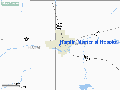
Hamlin Memorial Hospital Heliport |
Location & QuickFacts
| FAA Information Effective: | 2008-09-25 |
| Airport Identifier: | 48TA |
| Airport Status: | Operational |
| Longitude/Latitude: | 100-08-07.3670W/32-53-08.3860N
-100.135380/32.885663 (Estimated) |
| Elevation: | 1750 ft / 533.40 m (Estimated) |
| Land: | 0 acres |
| From nearest city: | 0 nautical miles N of Hamlin, TX |
| Location: | Jones County, TX |
| Magnetic Variation: | 08E (1985) |
Owner & Manager
| Ownership: | Privately owned |
| Owner: | Hamlin Memorial Hospital |
| Address: | 632 Nw 2nd St.
Hamlin, TX 79520 |
| Phone number: | 915-576-3646 |
| Manager: | Chuck Latham, Administrator |
| Address: | 632 Nw 2nd St.
Hamlin, TX 79520 |
| Phone number: | 915-576-3646 |
Airport Operations and Facilities
| Airport Use: | Private
MEDICAL. |
| Wind indicator: | Yes |
| Segmented Circle: | No |
| Control Tower: | No |
| Lighting Schedule: | PHONE REQ
FOR PERIMETER LGTS CALL 915-576-3646. |
| Sectional chart: | Dallas-ft Worth |
| Region: | ASW - Southwest |
| Boundary ARTCC: | ZFW - Fort Worth |
| Tie-in FSS: | FTW - Fort Worth |
| FSS on Airport: | No |
| FSS Phone: | 817-541-3474 |
| FSS Toll Free: | 1-800-WX-BRIEF |
Runway Information
Helipad H1
| Dimension: | 30 x 30 ft / 9.1 x 9.1 m |
| Surface: | CONC, |
| |
Runway H1 |
Runway |
| Traffic Pattern: | Left | Left |
|
Radio Navigation Aids
| ID |
Type |
Name |
Ch |
Freq |
Var |
Dist |
| TMV | NDB | Stamford | | 290.00 | 08E | 20.3 nm |
| AKL | NDB | Haskell | | 407.00 | 08E | 27.8 nm |
| SWW | NDB | Sweetwater | | 275.00 | 08E | 30.5 nm |
| SDR | NDB | Snyder | | 359.00 | 08E | 42.4 nm |
| DYS | TACAN | Dyess | 063X | | 08E | 31.4 nm |
| TQA | VOR/DME | Tuscola | 053X | 111.60 | 10E | 42.3 nm |
| ABI | VORTAC | Abilene | 084X | 113.70 | 10E | 27.9 nm |
Images and information placed above are from
http://www.airport-data.com/airport/48TA/
We thank them for the data!
| General Info
|
| Country |
United States
|
| State |
TEXAS
|
| FAA ID |
48TA
|
| Latitude |
32-53-08.386N
|
| Longitude |
100-08-07.367W
|
| Elevation |
1750 feet
|
| Near City |
HAMLIN
|
We don't guarantee the information is fresh and accurate. The data may
be wrong or outdated.
For more up-to-date information please refer to other sources.
|
|


