 |
|
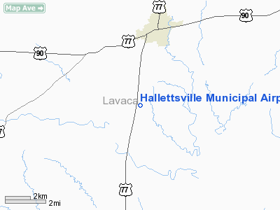
Hallettsville Muni Airport |
Location & QuickFacts
| FAA Information Effective: | 2008-09-25 |
| Airport Identifier: | 34R |
| Airport Status: | Operational |
| Longitude/Latitude: | 096-57-21.8150W/29-23-23.8500N
-96.956060/29.389958 (Estimated) |
| Elevation: | 278 ft / 84.73 m (Surveyed) |
| Land: | 40 acres |
| From nearest city: | 3 nautical miles S of Hallettsville, TX |
| Location: | Lavaca County, TX |
| Magnetic Variation: | 07E (1985) |
Owner & Manager
| Ownership: | Publicly owned |
| Owner: | City Of Hallettsville |
| Address: | 101 N Main
Hallettsville, TX 77964 |
| Phone number: | 361-798-3681 |
| Manager: | Ervin Kolacny
DIRECTOR OF PUBLIC WORKS. |
| Address: | 101 N Main
Hallettsville, TX 77964 |
| Phone number: | 361-798-2201 |
Airport Operations and Facilities
| Airport Use: | Open to public |
| Wind indicator: | Yes |
| Segmented Circle: | Yes |
| Control Tower: | No |
| Lighting Schedule: | DUSK-DAWN
MIRL RY 17/35 PRESET LOW INTST; TO INCR INTST ACTVT - CTAF. |
| Beacon Color: | Clear-Green (lighted land airport) |
| Landing fee charge: | No |
| Sectional chart: | Houston |
| Region: | ASW - Southwest |
| Boundary ARTCC: | ZHU - Houston |
| Tie-in FSS: | CXO - Montgomery County |
| FSS on Airport: | No |
| FSS Toll Free: | 1-800-WX-BRIEF
FOR FP FILING CALL CXO FSS 1-800-833-5602 |
| NOTAMs Facility: | CXO (NOTAM-d service avaliable) |
| Federal Agreements: | 1Y |
Airport Communications
Airport Services
| Fuel available: | 100LL
24 HR SELF-SERVE CREDIT CARD OPN FOR FUEL. |
| Bottled Oxygen: | NONE |
| Bulk Oxygen: | NONE |
Runway Information
Runway 17/35
| Dimension: | 3210 x 60 ft / 978.4 x 18.3 m |
| Surface: | ASPH, Good Condition |
| Weight Limit: | Single wheel: 7000 lbs. |
| Edge Lights: | Medium |
| |
Runway 17 |
Runway 35 |
| Longitude: | 096-57-22.1300W | 096-57-21.5000W |
| Latitude: | 29-23-39.7400N | 29-23-07.9600N |
| Elevation: | 278.00 ft | 262.00 ft |
| Alignment: | 127 | 127 |
| Traffic Pattern: | Left | Left |
| Markings: | Basic, Fair Condition | Basic, Fair Condition |
| Crossing Height: | 12.00 ft | 0.00 ft |
| VASI: | tri-color on left side | |
| Visual Glide Angle: | 3.30° | 0.00° |
| Obstruction: | 32 ft trees, 558.0 ft from runway, 160 ft left of centerline, 11:1 slope to clear | 14 ft trees, 401.0 ft from runway, 76 ft right of centerline, 14:1 slope to clear |
|
Radio Navigation Aids
| ID |
Type |
Name |
Ch |
Freq |
Var |
Dist |
| OKT | NDB | Yoakum | | 350.00 | 06E | 10.7 nm |
| ARM | NDB | Wharton | | 245.00 | 06E | 42.9 nm |
| PKV | NDB | Port Lavaca | | 515.00 | 05E | 46.7 nm |
| GYB | NDB | Lee County | | 385.00 | 07E | 46.9 nm |
| VCT | VOR/DME | Victoria | 027X | 109.00 | 06E | 29.5 nm |
| ELA | VOR/DME | Eagle Lake | 111X | 116.40 | 08E | 37.2 nm |
| IDU | VORTAC | Industry | 039X | 110.20 | 08E | 39.8 nm |
Images and information placed above are from
http://www.airport-data.com/airport/34R/
We thank them for the data!
| General Info
|
| Country |
United States
|
| State |
TEXAS
|
| FAA ID |
34R
|
| Latitude |
29-23-23.850N
|
| Longitude |
096-57-21.815W
|
| Elevation |
278 feet
|
| Near City |
HALLETTSVILLE
|
We don't guarantee the information is fresh and accurate. The data may
be wrong or outdated.
For more up-to-date information please refer to other sources.
|
|


