 |
|
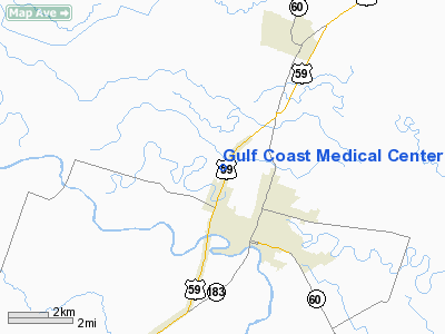
Gulf Coast Medical Center Heliport |
Location & QuickFacts
| FAA Information Effective: | 2008-09-25 |
| Airport Identifier: | TE07 |
| Airport Status: | Operational |
| Longitude/Latitude: | 096-07-01.8540W/29-20-39.8880N
-96.117182/29.344413 (Estimated) |
| Elevation: | 110 ft / 33.53 m (Estimated) |
| Land: | 0 acres |
| From nearest city: | 0 nautical miles N of Wharton, TX |
| Location: | Wharton County, TX |
| Magnetic Variation: | 06E (1985) |
Owner & Manager
| Ownership: | Privately owned |
| Owner: | Gulf Coast Medical Center |
| Address: | 1400 Highway 59 Bypass
Wharton, TX 77488 |
| Phone number: | 409-532-2500 |
| Manager: | L. Gene Mathews |
| Address: | 1400 Highway 59 Bypass
Wharton, TX 77488 |
| Phone number: | 409-532-2500 |
Airport Operations and Facilities
| Airport Use: | Private
MEDICAL |
| Wind indicator: | Yes |
| Segmented Circle: | No |
| Control Tower: | No |
| Lighting Schedule: | PHONE REQ
FOR PERIMETER LGTS CALL 409-532-2500. |
| Sectional chart: | Houston |
| Region: | ASW - Southwest |
| Boundary ARTCC: | ZHU - Houston |
| Tie-in FSS: | CXO - Montgomery County |
| FSS Toll Free: | 1-800-WX-BRIEF
FOR FP FILING CALL CXO FSS 1-800-833-5602. |
Runway Information
Helipad H1
| Dimension: | 50 x 50 ft / 15.2 x 15.2 m |
| Surface: | CONC, |
| |
Runway H1 |
Runway |
| Traffic Pattern: | Left | Left |
|
Radio Navigation Aids
| ID |
Type |
Name |
Ch |
Freq |
Var |
Dist |
| ARM | NDB | Wharton | | 245.00 | 06E | 5.7 nm |
| BYY | NDB | Bay City | | 344.00 | 06E | 26.1 nm |
| SGR | NDB | Hull | | 388.00 | 05E | 29.7 nm |
| SYG | NDB | Sandy Point | | 402.00 | 05E | 35.3 nm |
| LYD | NDB | Lakeside | | 249.00 | 05E | 36.5 nm |
| EYQ | NDB | Weiser | | 286.00 | 06E | 43.3 nm |
| ELA | VOR/DME | Eagle Lake | 111X | 116.40 | 08E | 21.8 nm |
| HUB | VOR/DME | Hobby | 118X | 117.10 | 05E | 47.8 nm |
| PSX | VORTAC | Palacios | 120X | 117.30 | 08E | 36.2 nm |
| IDU | VORTAC | Industry | 039X | 110.20 | 08E | 43.5 nm |
| HOU | VOT | Houston Wm P Hobby | | 108.40 | | 47.4 nm |
Images and information placed above are from
http://www.airport-data.com/airport/TE07/
We thank them for the data!
| General Info
|
| Country |
United States
|
| State |
TEXAS
|
| FAA ID |
TE07
|
| Latitude |
29-20-39.888N
|
| Longitude |
096-07-01.854W
|
| Elevation |
110 feet
|
| Near City |
WHARTON
|
We don't guarantee the information is fresh and accurate. The data may
be wrong or outdated.
For more up-to-date information please refer to other sources.
|
|


