 |
|
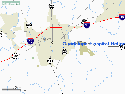
Guadalupe Hospital Heliport |
Location & QuickFacts
| FAA Information Effective: | 2008-09-25 |
| Airport Identifier: | XS98 |
| Airport Status: | Operational |
| Longitude/Latitude: | 097-56-48.0150W/29-34-02.8280N
-97.946671/29.567452 (Estimated) |
| Elevation: | 530 ft / 161.54 m (Estimated) |
| Land: | 0 acres |
| From nearest city: | 0 nautical miles E of Seguin, TX |
| Location: | Guadalupe County, TX |
| Magnetic Variation: | 07E (1985) |
Owner & Manager
| Ownership: | Publicly owned |
| Owner: | Guadalupe Valley Hosp |
| Address: | 1215 East Court
Seguin, TX 78155 |
| Phone number: | 210-379-2411 |
| Manager: | Admin: Don Richey |
| Address: | 1215 East Court
Seguin, TX 78155 |
| Phone number: | 210-379-2411 |
Airport Operations and Facilities
| Airport Use: | Private
MEDICAL |
| Wind indicator: | Yes |
| Segmented Circle: | No |
| Control Tower: | No |
| Lighting Schedule: | PHONE REQ
FOR PERIMETER LGTS CALL 512-379-2411. |
| Sectional chart: | San Antonio |
| Region: | ASW - Southwest |
| Boundary ARTCC: | ZHU - Houston |
| Tie-in FSS: | SJT - San Angelo |
| FSS on Airport: | No |
| FSS Toll Free: | 1-800-WX-BRIEF |
Runway Information
Helipad H1
| Dimension: | 40 x 40 ft / 12.2 x 12.2 m |
| Surface: | CONC, |
| |
Runway H1 |
Runway |
| Traffic Pattern: | Left | Left |
|
Radio Navigation Aids
| ID |
Type |
Name |
Ch |
Freq |
Var |
Dist |
| OKT | NDB | Yoakum | | 350.00 | 06E | 45.0 nm |
| PEZ | NDB | Pleasanton | | 275.00 | 07E | 47.5 nm |
| CVB | NDB | Castroville | | 338.00 | 08E | 49.1 nm |
| DHK | TACAN | Randolph | 036X | | 09E | 16.9 nm |
| KSY | TACAN | Kelly | 057X | | 07E | 34.8 nm |
| SSF | VOR | Stinson | | 108.40 | 09E | 32.0 nm |
| RND | VORTAC | Randolph | 70X | 112.30 | 09E | 17.9 nm |
| SAT | VORTAC | San Antonio | 115X | 116.80 | 08E | 27.3 nm |
| SAT | VOT | San Antonio Intl | | 110.40 | | 27.4 nm |
Images and information placed above are from
http://www.airport-data.com/airport/XS98/
We thank them for the data!
| General Info
|
| Country |
United States
|
| State |
TEXAS
|
| FAA ID |
XS98
|
| Latitude |
29-34-02.828N
|
| Longitude |
097-56-48.015W
|
| Elevation |
530 feet
|
| Near City |
SEGUIN
|
We don't guarantee the information is fresh and accurate. The data may
be wrong or outdated.
For more up-to-date information please refer to other sources.
|
|


