 |
|
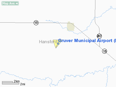
Location & QuickFacts
| FAA Information Effective: | 2008-09-25 |
| Airport Identifier: | E19 |
| Airport Status: | Operational |
| Longitude/Latitude: | 101-25-55.8820W/36-14-01.4140N
-101.432189/36.233726 (Estimated) |
| Elevation: | 3205 ft / 976.88 m (Surveyed) |
| Land: | 182 acres |
| From nearest city: | 2 nautical miles SW of Gruver, TX |
| Location: | Hansford County, TX |
| Magnetic Variation: | 09E (1965) |
Owner & Manager
| Ownership: | Publicly owned |
| Owner: | City Of Gruver |
| Address: | Po Box 947
Gruver, TX 79040 |
| Phone number: | 806-733-2424 |
| Manager: | Linda Weller
CITY MANAGER. |
| Address: | Po Box 947
Gruver, TX 79040 |
| Phone number: | 806-733-2424 |
Airport Operations and Facilities
| Airport Use: | Open to public |
| Wind indicator: | Yes |
| Segmented Circle: | Yes |
| Control Tower: | No |
| Lighting Schedule: | DUSK-DAWN |
| Beacon Color: | Clear-Green (lighted land airport) |
| Landing fee charge: | No |
| Sectional chart: | Wichita |
| Region: | ASW - Southwest |
| Boundary ARTCC: | ZAB - Albuquerque |
| Tie-in FSS: | FTW - Fort Worth |
| FSS on Airport: | No |
| FSS Phone: | 817-541-3474 |
| FSS Toll Free: | 1-800-WX-BRIEF |
| NOTAMs Facility: | FTW (NOTAM-d service avaliable) |
| Federal Agreements: | NGY |
Airport Communications
Airport Services
| Airframe Repair: | NONE |
| Power Plant Repair: | NONE |
| Bottled Oxygen: | NONE |
| Bulk Oxygen: | NONE |
Runway Information
Runway 02/20
| Dimension: | 4698 x 60 ft / 1432.0 x 18.3 m |
| Surface: | ASPH, Good Condition |
| Weight Limit: | Single wheel: 12500 lbs. |
| Edge Lights: | Medium |
| |
Runway 02 |
Runway 20 |
| Longitude: | 101-26-10.4000W | 101-25-41.3860W |
| Latitude: | 36-13-41.3540N | 36-14-21.4220N |
| Elevation: | 3205.00 ft | 3187.00 ft |
| Alignment: | 30 | 127 |
| Traffic Pattern: | Left | Left |
| Markings: | Non-precision instrument, Good Condition | Non-precision instrument, Good Condition |
| Obstruction: | , 50:1 slope to clear | 4 ft fence, 370.0 ft from runway, 140 ft right of centerline, 42:1 slope to clear |
|
Radio Navigation Aids
| ID |
Type |
Name |
Ch |
Freq |
Var |
Dist |
| GUY | NDB | Guymon | | 275.00 | 09E | 28.6 nm |
| PYX | NDB | Perryton | | 266.00 | 09E | 34.8 nm |
| DUX | NDB | Durrett | | 414.00 | 09E | 35.9 nm |
| PPA | NDB | Pampa | | 368.00 | 09E | 43.0 nm |
| BGD | VORTAC | Borger | 023X | 108.60 | 11E | 25.8 nm |
Images and information placed above are from
http://www.airport-data.com/airport/E19/
We thank them for the data!
| General Info
|
| Country |
United States
|
| State |
TEXAS
|
| FAA ID |
E19
|
| Latitude |
36-14-01.414N
|
| Longitude |
101-25-55.882W
|
| Elevation |
3205 feet
|
| Near City |
GRUVER
|
We don't guarantee the information is fresh and accurate. The data may
be wrong or outdated.
For more up-to-date information please refer to other sources.
|
|


