 |
|
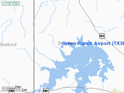
Location & QuickFacts
| FAA Information Effective: | 2008-09-25 |
| Airport Identifier: | TX36 |
| Airport Status: | Operational |
| Longitude/Latitude: | 099-02-31.2580W/32-50-00.4200N
-99.042016/32.833450 (Estimated) |
| Elevation: | 1190 ft / 362.71 m (Estimated) |
| Land: | 0 acres |
| From nearest city: | 8 nautical miles NW of Breckenridge, TX |
| Location: | Stephens County, TX |
| Magnetic Variation: | 08E (1985) |
Owner & Manager
| Ownership: | Privately owned |
| Owner: | Bob Green |
| Address: | Green Ranch
Albany, TX 76430 |
| Phone number: | 915-762-2474 |
| Manager: | Bob Green |
| Address: | Po Box 1058
Albany, TX 76430 |
| Phone number: | 915-762-2474 |
Airport Operations and Facilities
| Airport Use: | Private |
| Wind indicator: | No |
| Segmented Circle: | No |
| Control Tower: | No |
| Landing fee charge: | No |
| Sectional chart: | Dallas-ft Worth |
| Region: | ASW - Southwest |
| Boundary ARTCC: | ZFW - Fort Worth |
| Tie-in FSS: | FTW - Fort Worth |
| FSS on Airport: | No |
| FSS Phone: | 817-541-3474 |
| FSS Toll Free: | 1-800-WX-BRIEF |
Runway Information
Runway 17/35
| Dimension: | 4000 x 100 ft / 1219.2 x 30.5 m |
| Surface: | TURF, |
| |
Runway 17 |
Runway 35 |
| Traffic Pattern: | Left | Left |
|
Radio Navigation Aids
| ID |
Type |
Name |
Ch |
Freq |
Var |
Dist |
| BKD | NDB | Breckenridge | | 245.00 | 07E | 9.2 nm |
| OIP | NDB | Old Rip | | 410.00 | 07E | 28.7 nm |
| GZV | NDB | Brazos River | | 280.00 | 07E | 32.5 nm |
| ONY | NDB | Olney | | 272.00 | 07E | 33.1 nm |
| GHX | NDB | Graham | | 371.00 | 07E | 34.0 nm |
| TMV | NDB | Stamford | | 290.00 | 08E | 35.0 nm |
| AKL | NDB | Haskell | | 407.00 | 08E | 40.4 nm |
| MWL | NDB | Mineral Wells | | 266.00 | 06E | 49.8 nm |
| DYS | TACAN | Dyess | 063X | | 08E | 48.2 nm |
| ABI | VORTAC | Abilene | 084X | 113.70 | 10E | 46.6 nm |
Remarks
Images and information placed above are from
http://www.airport-data.com/airport/TX36/
We thank them for the data!
| General Info
|
| Country |
United States
|
| State |
TEXAS
|
| FAA ID |
TX36
|
| Latitude |
32-50-00.420N
|
| Longitude |
099-02-31.258W
|
| Elevation |
1190 feet
|
| Near City |
BRECKENRIDGE
|
We don't guarantee the information is fresh and accurate. The data may
be wrong or outdated.
For more up-to-date information please refer to other sources.
|
|


