 |
|
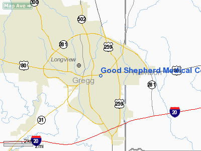
Good Shepherd Medical Center Heliport |
Location & QuickFacts
| FAA Information Effective: | 2008-09-25 |
| Airport Identifier: | 3XS6 |
| Airport Status: | Operational |
| Longitude/Latitude: | 094-43-47.0000W/32-30-01.0000N
-94.729722/32.500278 (Estimated) |
| Elevation: | 359 ft / 109.42 m (Estimated) |
| Land: | 0 acres |
| From nearest city: | 0 nautical miles N of Longview, TX |
| Location: | Gregg County, TX |
| Magnetic Variation: | 05E (1995) |
Owner & Manager
| Ownership: | Privately owned |
| Owner: | Good Shepherd Medical Center |
| Address: | 700 E Marshall
Longview, TX 75601 |
| Phone number: | 903-236-2000 |
| Manager: | Jerry D Adair
PRESIDENT/CEO. |
| Address: | 700 E Marshall
Longview, TX 75601 |
| Phone number: | 903-236-2111 |
Airport Operations and Facilities
| Airport Use: | Private
MEDICAL. |
| Wind indicator: | Yes |
| Segmented Circle: | No |
| Control Tower: | No |
| Lighting Schedule: | PHONE REQ
FOR PERIMETER LGTS CALL 903-236-2000. |
| Sectional chart: | Memphis |
| Region: | ASW - Southwest |
| Boundary ARTCC: | ZFW - Fort Worth |
| Tie-in FSS: | FTW - Fort Worth |
| FSS on Airport: | No |
| FSS Phone: | 817-541-3474 |
| FSS Toll Free: | 1-800-WX-BRIEF |
Runway Information
Helipad H1
| Dimension: | 40 x 40 ft / 12.2 x 12.2 m |
| Surface: | CONC, |
| |
Runway H1 |
Runway |
| Traffic Pattern: | Left | Left |
|
Radio Navigation Aids
| ID |
Type |
Name |
Ch |
Freq |
Var |
Dist |
| HNO | NDB | Henderson | | 371.00 | 06E | 19.9 nm |
| ABG | NDB | Ambassador | | 404.00 | 07E | 20.1 nm |
| LST | NDB | Lone Star | | 305.00 | 05E | 25.7 nm |
| RPF | NDB | Carthage | | 332.00 | 04E | 29.2 nm |
| TY | NDB | Tyler | | 320.00 | 06E | 37.9 nm |
| VIV | NDB | Vivian | | 284.00 | 06E | 42.3 nm |
| JSO | NDB | Cherokee County | | 263.00 | 05E | 45.2 nm |
| ATA | NDB | Atlanta | | 347.00 | 04E | 45.4 nm |
| CZJ | NDB | Amason | | 341.00 | 04E | 49.7 nm |
| TYR | VOR/DME | Tyler | 089X | 114.20 | 06E | 35.3 nm |
| UIM | VOR/DME | Quitman | 087X | 114.00 | 08E | 39.5 nm |
| FZT | VOR/DME | Frankston | 051X | 111.40 | 06E | 48.1 nm |
| GGG | VORTAC | Gregg County | 070X | 112.30 | 07E | 5.1 nm |
| EIC | VORTAC | Belcher | 121X | 117.40 | 07E | 49.3 nm |
| SHV | VOT | Shreveport Regional | | 108.20 | | 45.8 nm |
Images and information placed above are from
http://www.airport-data.com/airport/3XS6/
We thank them for the data!
| General Info
|
| Country |
United States
|
| State |
TEXAS
|
| FAA ID |
3XS6
|
| Latitude |
32-30-01.000N
|
| Longitude |
094-43-47.000W
|
| Elevation |
359 feet
|
| Near City |
LONGVIEW
|
We don't guarantee the information is fresh and accurate. The data may
be wrong or outdated.
For more up-to-date information please refer to other sources.
|
|


