 |
|
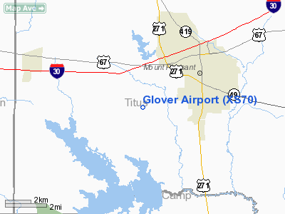
Location & QuickFacts
| FAA Information Effective: | 2008-09-25 |
| Airport Identifier: | XS70 |
| Airport Status: | Operational |
| Longitude/Latitude: | 095-01-04.7700W/33-08-04.4300N
-95.017992/33.134564 (Estimated) |
| Elevation: | 400 ft / 121.92 m (Estimated) |
| Land: | 40 acres |
| From nearest city: | 3 nautical miles S of Mount Pleasant, TX |
| Location: | Titus County, TX |
| Magnetic Variation: | 04E (2000) |
Owner & Manager
| Ownership: | Privately owned |
| Owner: | Scott Glover |
| Address: | Po Box 287
Mount Pleasant, TX 75456-0287 |
| Phone number: | 903-572-7552 |
| Manager: | Scott Glover |
| Address: | Po Box 287
Mount Pleasant, TX 75456-0287 |
| Phone number: | 903-572-7552 |
Airport Operations and Facilities
| Airport Use: | Private |
| Segmented Circle: | No |
| Control Tower: | No |
| Sectional chart: | Dallas-ft Worth |
| Region: | ASW - Southwest |
| Boundary ARTCC: | ZFW - Fort Worth |
| Tie-in FSS: | FTW - Fort Worth |
| FSS Phone: | 817-541-3474 |
| FSS Toll Free: | 1-800-WX-BRIEF |
Runway Information
Runway 16/34
| Dimension: | 3300 x 100 ft / 1005.8 x 30.5 m |
| Surface: | TURF, |
| |
Runway 16 |
Runway 34 |
| Traffic Pattern: | Right | Left |
| Obstruction: | 40 ft trees, 300.0 ft from runway | |
|
Radio Navigation Aids
| ID |
Type |
Name |
Ch |
Freq |
Var |
Dist |
| LST | NDB | Lone Star | | 305.00 | 05E | 18.6 nm |
| ABG | NDB | Ambassador | | 404.00 | 07E | 33.4 nm |
| ATA | NDB | Atlanta | | 347.00 | 04E | 41.7 nm |
| IBO | NDB | Idabel | | 271.00 | 03E | 47.2 nm |
| TY | NDB | Tyler | | 320.00 | 06E | 48.9 nm |
| UIM | VOR/DME | Quitman | 087X | 114.00 | 08E | 23.3 nm |
| SLR | VOR/DME | Sulphur Springs | 027X | 109.00 | 08E | 26.7 nm |
| PRX | VOR/DME | Paris | 083X | 113.60 | 07E | 32.7 nm |
| GGG | VORTAC | Gregg County | 070X | 112.30 | 07E | 45.1 nm |
Remarks
- PRVDD ALL TFC PATTERN OPNS ARE WEST OF EXTDD CNTRLN.
Images and information placed above are from
http://www.airport-data.com/airport/XS70/
We thank them for the data!
| General Info
|
| Country |
United States
|
| State |
TEXAS
|
| FAA ID |
XS70
|
| Latitude |
33-08-04.430N
|
| Longitude |
095-01-04.770W
|
| Elevation |
400 feet
|
| Near City |
MOUNT PLEASANT
|
We don't guarantee the information is fresh and accurate. The data may
be wrong or outdated.
For more up-to-date information please refer to other sources.
|
|


