 |
|
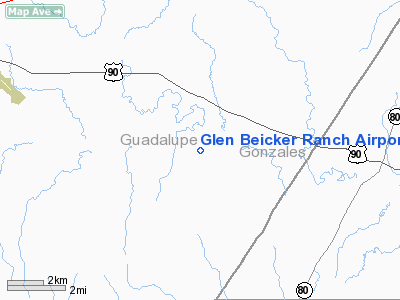
Glen Beicker Ranch Airport |
Location & QuickFacts
| FAA Information Effective: | 2008-09-25 |
| Airport Identifier: | 83R |
| Airport Status: | Operational |
| Longitude/Latitude: | 097-47-18.0030W/29-31-45.8370N
-97.788334/29.529399 (Estimated) |
| Elevation: | 465 ft / 141.73 m (Estimated) |
| Land: | 160 acres |
| From nearest city: | 10 nautical miles E of Seguin, TX |
| Location: | Guadalupe County, TX |
| Magnetic Variation: | 07E (1985) |
Owner & Manager
| Ownership: | Privately owned |
| Owner: | R. G. Beicker |
| Address: | 700 Gus Beicker Road
Seguin, TX 78155 |
| Phone number: | 830-303-1829 |
| Manager: | R G Beicker |
| Address: | 700 Gus Beicker Road
Seguin, TX 78155 |
| Phone number: | 830-303-1829 |
Airport Operations and Facilities
| Airport Use: | Open to public |
| Wind indicator: | Yes |
| Segmented Circle: | No |
| Control Tower: | No |
| Landing fee charge: | No |
| Sectional chart: | San Antonio |
| Region: | ASW - Southwest |
| Boundary ARTCC: | ZHU - Houston |
| Tie-in FSS: | SJT - San Angelo |
| FSS on Airport: | No |
| FSS Toll Free: | 1-800-WX-BRIEF |
| NOTAMs Facility: | SJT (NOTAM-d service avaliable) |
Airport Communications
Airport Services
| Airframe Repair: | MAJOR |
| Power Plant Repair: | MAJOR |
Runway Information
Runway 17/35
| Dimension: | 1950 x 50 ft / 594.4 x 15.2 m |
| Surface: | TURF, Good Condition |
| |
Runway 17 |
Runway 35 |
| Traffic Pattern: | Left | Left |
| Obstruction: | 35 ft trees, 500.0 ft from runway, 14:1 slope to clear | 16 ft tree, 100.0 ft from runway, 110 ft right of centerline, 6:1 slope to clear |
|
Radio Navigation Aids
| ID |
Type |
Name |
Ch |
Freq |
Var |
Dist |
| OKT | NDB | Yoakum | | 350.00 | 06E | 36.4 nm |
| DHK | TACAN | Randolph | 036X | | 09E | 25.1 nm |
| KSY | TACAN | Kelly | 057X | | 07E | 42.3 nm |
| SSF | VOR | Stinson | | 108.40 | 09E | 38.0 nm |
| RND | VORTAC | Randolph | 70X | 112.30 | 09E | 26.0 nm |
| SAT | VORTAC | San Antonio | 115X | 116.80 | 08E | 35.8 nm |
| SAT | VOT | San Antonio Intl | | 110.40 | | 35.7 nm |
Remarks
- DEER ON & INVOF RY.
- GRASS ROOTS FLYING.
Images and information placed above are from
http://www.airport-data.com/airport/83R/
We thank them for the data!
| General Info
|
| Country |
United States
|
| State |
TEXAS
|
| FAA ID |
83R
|
| Latitude |
29-31-45.837N
|
| Longitude |
097-47-18.003W
|
| Elevation |
465 feet
|
| Near City |
SEGUIN
|
We don't guarantee the information is fresh and accurate. The data may
be wrong or outdated.
For more up-to-date information please refer to other sources.
|
|


