 |
|
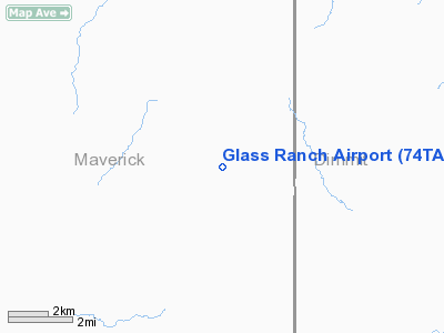
Location & QuickFacts
| FAA Information Effective: | 2008-09-25 |
| Airport Identifier: | 74TA |
| Airport Status: | Operational |
| Longitude/Latitude: | 100-09-01.2320W/28-27-00.9510N
-100.150342/28.450264 (Estimated) |
| Elevation: | 800 ft / 243.84 m (Estimated) |
| Land: | 0 acres |
| From nearest city: | 15 nautical miles SW of Carrizo Springs, TX |
| Location: | Maverick County, TX |
| Magnetic Variation: | 08E (1985) |
Owner & Manager
| Ownership: | Privately owned |
| Owner: | Brisco Ranch Inc. |
| Address: | Po Box 389
Uvalde, TX 78801 |
| Phone number: | 918-838-3059 |
| Manager: | Parker Drilling Co.
JOHN BUDD. |
| Address: | Hgr 26 Tulsa Int'l Arpt
Tulsa, OK 74115 |
Airport Operations and Facilities
| Airport Use: | Private |
| Wind indicator: | Yes |
| Segmented Circle: | No |
| Control Tower: | No |
| Landing fee charge: | No |
| Sectional chart: | San Antonio |
| Region: | ASW - Southwest |
| Boundary ARTCC: | ZHU - Houston |
| Tie-in FSS: | SJT - San Angelo |
| FSS on Airport: | No |
| FSS Toll Free: | 1-800-WX-BRIEF |
Runway Information
Runway 08/26
| Dimension: | 5200 x 100 ft / 1585.0 x 30.5 m |
| Surface: | TURF-DIRT, |
| |
Runway 08 |
Runway 26 |
| Traffic Pattern: | Left | Left |
|
Radio Navigation Aids
| ID |
Type |
Name |
Ch |
Freq |
Var |
Dist |
| DMD | NDB | Dimmit County | | 343.00 | 07E | 17.6 nm |
| CPZ | NDB | Chaparrosa Ranch | | 385.00 | 10E | 28.7 nm |
| LKX | NDB | La Pryor | | 223.00 | 09E | 32.8 nm |
| PFO | NDB | Spofford | | 356.00 | 08E | 44.3 nm |
| UVA | NDB | Uvalde | | 281.00 | 07E | 49.1 nm |
Images and information placed above are from
http://www.airport-data.com/airport/74TA/
We thank them for the data!
| General Info
|
| Country |
United States
|
| State |
TEXAS
|
| FAA ID |
74TA
|
| Latitude |
28-27-00.951N
|
| Longitude |
100-09-01.232W
|
| Elevation |
800 feet
|
| Near City |
CARRIZO SPRINGS
|
We don't guarantee the information is fresh and accurate. The data may
be wrong or outdated.
For more up-to-date information please refer to other sources.
|
|


