 |
|
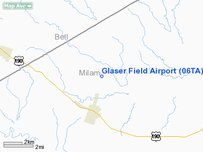
Location & QuickFacts
| FAA Information Effective: | 2008-09-25 |
| Airport Identifier: | 06TA |
| Airport Status: | Operational |
| Longitude/Latitude: | 097-07-00.9710W/30-54-30.6730N
-97.116936/30.908520 (Estimated) |
| Elevation: | 480 ft / 146.30 m (Estimated) |
| Land: | 0 acres |
| From nearest city: | 2 nautical miles N of Buckholts, TX |
| Location: | Milam County, TX |
| Magnetic Variation: | 07E (1985) |
Owner & Manager
| Ownership: | Privately owned |
| Owner: | Richard L Glaser |
| Address: | Rt 2 Box 15
Buckholts, TX 76518 |
| Phone number: | 817-593-3811 |
| Manager: | Richard L Glaser |
| Address: | Rt 2 Box 15
Buckholts, TX 76518 |
| Phone number: | 817-593-3127 |
Airport Operations and Facilities
| Airport Use: | Private |
| Wind indicator: | No |
| Segmented Circle: | No |
| Control Tower: | No |
| Landing fee charge: | No |
| Sectional chart: | San Antonio |
| Region: | ASW - Southwest |
| Boundary ARTCC: | ZHU - Houston |
| Tie-in FSS: | SJT - San Angelo |
| FSS on Airport: | No |
| FSS Toll Free: | 1-800-WX-BRIEF |
Runway Information
Runway N/S
| Dimension: | 1900 x 15 ft / 579.1 x 4.6 m |
| Surface: | GRAVEL, |
| |
Runway N |
Runway S |
| Traffic Pattern: | Left | Left |
| Obstruction: | 5 ft fence, 150.0 ft from runway | 30 ft tree, 0.0 ft from runway |
|
Radio Navigation Aids
| ID |
Type |
Name |
Ch |
Freq |
Var |
Dist |
| IL | NDB | Iresh | | 278.00 | 07E | 31.2 nm |
| GUO | NDB | Georgetown | | 332.00 | 06E | 32.0 nm |
| HLR | NDB | Hood | | 347.00 | 07E | 33.4 nm |
| ROB | NDB | Robinson | | 400.00 | 07E | 35.9 nm |
| GR | NDB | Starn | | 323.00 | 07E | 42.2 nm |
| GYB | NDB | Lee County | | 385.00 | 07E | 45.0 nm |
| TPL | VOR/DME | Temple | 041X | 110.40 | 09E | 24.1 nm |
| GRK | VOR/DME | Gray | 055X | 111.80 | 07E | 36.7 nm |
| GNL | VOR/DME | Groesbeck | 025X | 108.80 | 05E | 49.9 nm |
| CWK | VORTAC | Centex | 075X | 112.80 | 06E | 38.4 nm |
| CLL | VORTAC | College Station | 080X | 113.30 | 08E | 40.3 nm |
| ACT | VORTAC | Waco | 100X | 115.30 | 09E | 46.0 nm |
Remarks
Images and information placed above are from
http://www.airport-data.com/airport/06TA/
We thank them for the data!
| General Info
|
| Country |
United States
|
| State |
TEXAS
|
| FAA ID |
06TA
|
| Latitude |
30-54-30.673N
|
| Longitude |
097-07-00.971W
|
| Elevation |
480 feet
|
| Near City |
BUCKHOLTS
|
We don't guarantee the information is fresh and accurate. The data may
be wrong or outdated.
For more up-to-date information please refer to other sources.
|
|


