 |
|
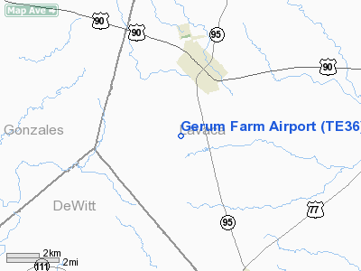
Location & QuickFacts
| FAA Information Effective: | 2008-09-25 |
| Airport Identifier: | TE36 |
| Airport Status: | Operational |
| Longitude/Latitude: | 097-11-04.9530W/29-23-30.8740N
-97.184709/29.391909 (Estimated) |
| Elevation: | 425 ft / 129.54 m (Estimated) |
| Land: | 0 acres |
| From nearest city: | 3 nautical miles SW of Shiner, TX |
| Location: | Lavaca County, TX |
| Magnetic Variation: | 07E (1985) |
Owner & Manager
| Ownership: | Privately owned |
| Owner: | Lawrence G. Gerum |
| Address: | 2411 Bammel Timbers
Houston, TX 77068 |
| Phone number: | 713-444-3732 |
| Address: |
|
Airport Operations and Facilities
| Airport Use: | Private |
| Wind indicator: | Yes |
| Segmented Circle: | No |
| Control Tower: | No |
| Sectional chart: | San Antonio |
| Region: | ASW - Southwest |
| Boundary ARTCC: | ZHU - Houston |
| Tie-in FSS: | SJT - San Angelo |
| FSS Toll Free: | 1-800-WX-BRIEF |
Runway Information
Runway 17/35
| Dimension: | 2000 x 60 ft / 609.6 x 18.3 m |
| Surface: | TURF, |
| |
Runway 17 |
Runway 35 |
| Traffic Pattern: | Left | Left |
| Displaced threshold: | 400.00 ft | 200.00 ft |
| Obstruction: | 25 ft pline, 300.0 ft from runway | 25 ft pline, 350.0 ft from runway |
|
Radio Navigation Aids
| ID |
Type |
Name |
Ch |
Freq |
Var |
Dist |
| OKT | NDB | Yoakum | | 350.00 | 06E | 5.4 nm |
| GYB | NDB | Lee County | | 385.00 | 07E | 48.0 nm |
| VCT | VOR/DME | Victoria | 027X | 109.00 | 06E | 31.5 nm |
| ELA | VOR/DME | Eagle Lake | 111X | 116.40 | 08E | 48.2 nm |
| IDU | VORTAC | Industry | 039X | 110.20 | 08E | 47.0 nm |
Images and information placed above are from
http://www.airport-data.com/airport/TE36/
We thank them for the data!
| General Info
|
| Country |
United States
|
| State |
TEXAS
|
| FAA ID |
TE36
|
| Latitude |
29-23-30.874N
|
| Longitude |
097-11-04.953W
|
| Elevation |
425 feet
|
| Near City |
SHINER
|
We don't guarantee the information is fresh and accurate. The data may
be wrong or outdated.
For more up-to-date information please refer to other sources.
|
|


