 |
|
Location & QuickFacts
| FAA Information Effective: | 2008-09-25 |
| Airport Identifier: | 97TS |
| Airport Status: | Operational |
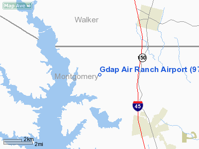
| Longitude/Latitude: | 095-32-23.7960W/30-28-48.7300N
-95.539943/30.480203 (Estimated) |
| Elevation: | 300 ft / 91.44 m (Estimated) |
| Land: | 9 acres |
| From nearest city: | 6 nautical miles NW of Willis, TX |
| Location: | Montgomery County, TX |
| Magnetic Variation: | 06E (1985) |
Owner & Manager
| Ownership: | Privately owned |
| Owner: | D. T. Hawk |
| Address: | Rt 1 Box 14a Shepard Hill Rd
Willis, TX 77378 |
| Phone number: | 409-856-5005 |
| Manager: | D. T. Hawk |
| Address: | Rt 1 Box 14a Shepard Hill Rd
Willis, TX 77378 |
| Phone number: | 409-856-5005 |
Airport Operations and Facilities
| Airport Use: | Private |
| Wind indicator: | Yes |
| Segmented Circle: | No |
| Control Tower: | No |
| Lighting Schedule: | PHONE REQ
FOR LIRL RY 15/33 CALL 409-856-5005. |
| Sectional chart: | Houston |
| Region: | ASW - Southwest |
| Boundary ARTCC: | ZHU - Houston |
| Tie-in FSS: | CXO - Montgomery County |
| FSS Toll Free: | 1-800-WX-BRIEF
FOR FP FILING CALL CXO FSS 1-800-833-5602. |
Runway Information
Runway 15/33
| Dimension: | 2500 x 150 ft / 762.0 x 45.7 m |
| Surface: | TURF, |
| Edge Lights: | Low
2250 FT NORTH END LGTD AND 2250 FT SOUTH END LGTD. |
| |
Runway 15 |
Runway 33 |
| Traffic Pattern: | Left | Left |
| Obstruction: | 35 ft pline | |
|
Radio Navigation Aids
| ID |
Type |
Name |
Ch |
Freq |
Var |
Dist |
| UTS | NDB | Huntsville | | 308.00 | 06E | 15.9 nm |
| DWH | NDB | David Hooks | | 521.00 | 05E | 21.4 nm |
| EYQ | NDB | Weiser | | 286.00 | 06E | 33.3 nm |
| BVP | NDB | Nixin | | 326.00 | 05E | 33.8 nm |
| LYD | NDB | Lakeside | | 249.00 | 05E | 40.5 nm |
| BNH | NDB | Brenham | | 362.00 | 06E | 45.9 nm |
| TNV | VORTAC | Navasota | 106X | 115.90 | 08E | 29.2 nm |
| IAH | VORTAC | Humble | 113X | 116.60 | 05E | 33.0 nm |
| LOA | VORTAC | Leona | 045X | 110.80 | 08E | 44.6 nm |
| CLL | VORTAC | College Station | 080X | 113.30 | 08E | 46.2 nm |
| DAS | VORTAC | Daisetta | 116X | 116.90 | 05E | 49.6 nm |
Remarks
- PROVIDED THRS DSPLCD TO PROVIDE 20:1 CLEARANCE.
Images and information placed above are from
http://www.airport-data.com/airport/97TS/
We thank them for the data!
| General Info
|
| Country |
United States
|
| State |
TEXAS
|
| FAA ID |
97TS
|
| Latitude |
30-28-48.730N
|
| Longitude |
095-32-23.796W
|
| Elevation |
300 feet
|
| Near City |
WILLIS
|
We don't guarantee the information is fresh and accurate. The data may
be wrong or outdated.
For more up-to-date information please refer to other sources.
|
|


