 |
|
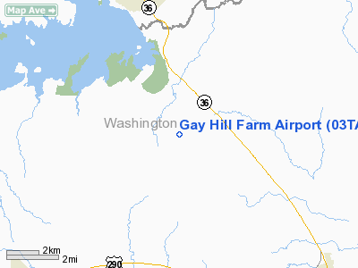
Location & QuickFacts
| FAA Information Effective: | 2008-09-25 |
| Airport Identifier: | 03TA |
| Airport Status: | Operational |
| Longitude/Latitude: | 096-30-00.8860W/30-15-45.7650N
-96.500246/30.262712 (Estimated) |
| Elevation: | 505 ft / 153.92 m (Estimated) |
| Land: | 0 acres |
| From nearest city: | 1 nautical miles SW of Gay Hill, TX |
| Location: | Washington County, TX |
| Magnetic Variation: | 06E (1985) |
Owner & Manager
| Ownership: | Privately owned |
| Owner: | Robert F Strange |
| Address: | Rt 4, Box 376
Brenham, TX 77833 |
| Phone number: | 409-836-6792 |
| Manager: | Robert F. Strange |
| Address: | Route 4, Box 376
Brenham, TX 77833 |
| Phone number: | 409-836-6792 |
Airport Operations and Facilities
| Airport Use: | Private |
| Wind indicator: | Yes |
| Segmented Circle: | No |
| Control Tower: | No |
| Landing fee charge: | No |
| Sectional chart: | Houston |
| Region: | ASW - Southwest |
| Boundary ARTCC: | ZHU - Houston |
| Tie-in FSS: | CXO - Montgomery County |
| FSS on Airport: | No |
| FSS Toll Free: | 1-800-WX-BRIEF
FOR FP FILING CALL CXO FSS 1-800-833-5602. |
Airport Services
| Airframe Repair: | NONE |
| Power Plant Repair: | NONE |
Runway Information
Runway 11/29
| Dimension: | 1900 x 90 ft / 579.1 x 27.4 m |
| Surface: | TURF, |
| |
Runway 11 |
Runway 29 |
| Traffic Pattern: | Right | Right |
|
Radio Navigation Aids
| ID |
Type |
Name |
Ch |
Freq |
Var |
Dist |
| BNH | NDB | Brenham | | 362.00 | 06E | 7.0 nm |
| GYB | NDB | Lee County | | 385.00 | 07E | 25.5 nm |
| EYQ | NDB | Weiser | | 286.00 | 06E | 48.9 nm |
| DWH | NDB | David Hooks | | 521.00 | 05E | 49.2 nm |
| ELA | VOR/DME | Eagle Lake | 111X | 116.40 | 08E | 37.3 nm |
| IDU | VORTAC | Industry | 039X | 110.20 | 08E | 18.7 nm |
| CLL | VORTAC | College Station | 080X | 113.30 | 08E | 21.0 nm |
| TNV | VORTAC | Navasota | 106X | 115.90 | 08E | 23.0 nm |
Remarks
Images and information placed above are from
http://www.airport-data.com/airport/03TA/
We thank them for the data!
| General Info
|
| Country |
United States
|
| State |
TEXAS
|
| FAA ID |
03TA
|
| Latitude |
30-15-45.765N
|
| Longitude |
096-30-00.886W
|
| Elevation |
505 feet
|
| Near City |
GAY HILL
|
We don't guarantee the information is fresh and accurate. The data may
be wrong or outdated.
For more up-to-date information please refer to other sources.
|
|


