 |
|
| Gardner Farm Airport |
| IATA: none – ICAO: none – FAA LID: 18XS |
| Summary |
| Airport type |
Private |
| Owner/Operator |
William F. Gardner |
| Location |
McAdoo, Texas |
| Elevation AMSL |
3,000 ft / 914 m |
| Coordinates |
33°48′00″N 101°02′02″W / 33.8°N 101.03389°W / 33.8; -101.03389 |
| Runways |
| Direction |
Length |
Surface |
| ft |
m |
| 17/35 |
2,400 |
732 |
Dirt |
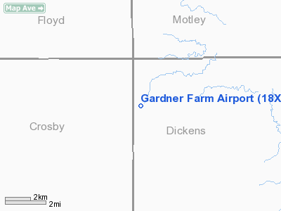
Gardner Farm Airport (FAA LID: 18XS) is a privately owned airport located 3 miles northwest of McAdoo, Texas, United States.
The above content comes from Wikipedia and is published under free licenses – click here to read more.
Location & QuickFacts
| FAA Information Effective: | 2008-09-25 |
| Airport Identifier: | 18XS |
| Airport Status: | Operational |
| Longitude/Latitude: | 101-02-01.5160W/33-48-00.2950N
-101.033754/33.800082 (Estimated) |
| Elevation: | 3000 ft / 914.40 m (Estimated) |
| Land: | 0 acres |
| From nearest city: | 3 nautical miles NW of Mc Adoo, TX |
| Location: | Dickens County, TX |
| Magnetic Variation: | 09E (1985) |
Owner & Manager
| Ownership: | Privately owned |
| Owner: | William F. Gardner |
| Address: | Rt 1
Mc Adoo, TX 79243 |
| Phone number: | 806-697-2698 |
| Address: |
|
Airport Operations and Facilities
| Airport Use: | Private |
| Wind indicator: | Yes |
| Segmented Circle: | No |
| Control Tower: | No |
| Landing fee charge: | No |
| Sectional chart: | Dallas-ft Worth |
| Region: | ASW - Southwest |
| Boundary ARTCC: | ZFW - Fort Worth |
| Tie-in FSS: | FTW - Fort Worth |
| FSS on Airport: | No |
| FSS Phone: | 817-541-3474 |
| FSS Toll Free: | 1-800-WX-BRIEF |
Runway Information
Runway 17/35
| Dimension: | 2400 x 40 ft / 731.5 x 12.2 m |
| Surface: | DIRT,
ROUGH & NOT MAINTAINED. |
| |
Runway 17 |
Runway 35 |
| Traffic Pattern: | Left | Left |
| Obstruction: | 5 ft fence, 100.0 ft from runway | |
|
Radio Navigation Aids
| ID |
Type |
Name |
Ch |
Freq |
Var |
Dist |
| CZX | NDB | Crosbyton | | 332.00 | 09E | 14.7 nm |
| PVW | VOR/DME | Plainview | 076X | 112.90 | 11E | 41.5 nm |
| GTH | VORTAC | Guthrie | 092X | 114.50 | 10E | 34.9 nm |
| LBB | VORTAC | Lubbock | 029X | 109.20 | 11E | 44.4 nm |
Remarks
- OWNER DESIRES ARPT NOT BE CHARTED.
- PROVIDED RWY THRS ARE LOCATED SO AS TO PROVIDE A MIN 20:1 CLEARANCE OVER OBSTRUCTIONS IN THE FINAL APCH AREAS.
Images and information placed above are from
http://www.airport-data.com/airport/18XS/
We thank them for the data!
| General Info
|
| Country |
United States
|
| State |
TEXAS
|
| FAA ID |
18XS
|
| Latitude |
33-48-00.295N
|
| Longitude |
101-02-01.516W
|
| Elevation |
3000 feet
|
| Near City |
MC ADOO
|
We don't guarantee the information is fresh and accurate. The data may
be wrong or outdated.
For more up-to-date information please refer to other sources.
|
|


