 |
|
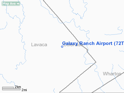
Location & QuickFacts
| FAA Information Effective: | 2008-09-25 |
| Airport Identifier: | 72TS |
| Airport Status: | Operational |
| Longitude/Latitude: | 096-37-20.9030W/29-21-38.8860N
-96.622473/29.360802 (Estimated) |
| Elevation: | 178 ft / 54.25 m (Estimated) |
| Land: | 1640 acres |
| From nearest city: | 10 nautical miles SE of Sheridan, TX |
| Location: | Lavaca County, TX |
| Magnetic Variation: | 07E (1985) |
Owner & Manager
| Ownership: | Privately owned |
| Owner: | Galaxy Energies Inc |
| Address: | Po Box 1873
Corpus Christi, TX 78403 |
| Phone number: | 512-888-6851
RANCH TELEPHONE - 512-798-4742. |
| Manager: | John Graefing |
| Address: | P.o. Box 1873
Corpus Christi, TX 78403 |
| Phone number: | 409-539-9851 |
Airport Operations and Facilities
| Airport Use: | Private |
| Wind indicator: | Yes |
| Segmented Circle: | No |
| Control Tower: | No |
| Sectional chart: | Houston |
| Region: | ASW - Southwest |
| Boundary ARTCC: | ZHU - Houston |
| Tie-in FSS: | CXO - Montgomery County |
| FSS Toll Free: | 1-800-WX-BRIEF
FOR FP FILING CALL CXO FSS 1-800-833-5602. |
Runway Information
Runway 17/35
| Dimension: | 3335 x 100 ft / 1016.5 x 30.5 m |
| Surface: | GRAVEL, |
| |
Runway 17 |
Runway 35 |
| Traffic Pattern: | Left | Left |
| Displaced threshold: | 0.00 ft | 500.00 ft |
| Obstruction: | | 30 ft pole, 60.0 ft from runway |
|
Radio Navigation Aids
| ID |
Type |
Name |
Ch |
Freq |
Var |
Dist |
| ARM | NDB | Wharton | | 245.00 | 06E | 25.5 nm |
| OKT | NDB | Yoakum | | 350.00 | 06E | 27.2 nm |
| PKV | NDB | Port Lavaca | | 515.00 | 05E | 42.8 nm |
| BYY | NDB | Bay City | | 344.00 | 06E | 46.4 nm |
| ELA | VOR/DME | Eagle Lake | 111X | 116.40 | 08E | 24.2 nm |
| VCT | VOR/DME | Victoria | 027X | 109.00 | 06E | 33.4 nm |
| IDU | VORTAC | Industry | 039X | 110.20 | 08E | 35.9 nm |
| PSX | VORTAC | Palacios | 120X | 117.30 | 08E | 39.5 nm |
Images and information placed above are from
http://www.airport-data.com/airport/72TS/
We thank them for the data!
| General Info
|
| Country |
United States
|
| State |
TEXAS
|
| FAA ID |
72TS
|
| Latitude |
29-21-38.886N
|
| Longitude |
096-37-20.903W
|
| Elevation |
178 feet
|
| Near City |
SHERIDAN
|
We don't guarantee the information is fresh and accurate. The data may
be wrong or outdated.
For more up-to-date information please refer to other sources.
|
|


