 |
|
Location & QuickFacts
| FAA Information Effective: | 2008-09-25 |
| Airport Identifier: | 36TA |
| Airport Status: | Operational |
| Longitude/Latitude: | 098-29-31.0640W/29-33-11.8220N
-98.491962/29.553284 (Estimated) |
| Elevation: | 824 ft / 251.16 m (Estimated) |
| Land: | 0 acres |
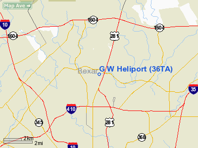
| From nearest city: | 4 nautical miles N of San Antonio, TX |
| Location: | Bexar County, TX |
| Magnetic Variation: | 07E (1985) |
Owner & Manager
| Ownership: | Privately owned |
| Owner: | G.l. Williams Co. |
| Address: | 12027 Warfield
San Antonio, TX 78216 |
| Phone number: | 512-341-2243 |
| Manager: | Hari W. Van Derheck |
| Address: | 12027 Warfield
San Antonio, TX 78216 |
| Phone number: | 512-341-2243 |
Airport Operations and Facilities
| Airport Use: | Private |
| Wind indicator: | Yes |
| Segmented Circle: | No |
| Control Tower: | No |
| Landing fee charge: | No |
| Sectional chart: | San Antonio |
| Region: | ASW - Southwest |
| Boundary ARTCC: | ZHU - Houston |
| Tie-in FSS: | SJT - San Angelo |
| FSS on Airport: | No |
| FSS Toll Free: | 1-800-WX-BRIEF |
Runway Information
Helipad H1
| Dimension: | 20 x 20 ft / 6.1 x 6.1 m |
| Surface: | CONC,
ROOFTOP. |
| |
Runway H1 |
Runway |
| Traffic Pattern: | Left | Left |
|
Radio Navigation Aids
| ID |
Type |
Name |
Ch |
Freq |
Var |
Dist |
| CVB | NDB | Castroville | | 338.00 | 08E | 22.5 nm |
| HHH | NDB | Devine | | 359.00 | 07E | 34.2 nm |
| ER | NDB | Shein | | 263.00 | 08E | 34.7 nm |
| PEZ | NDB | Pleasanton | | 275.00 | 07E | 36.0 nm |
| HMA | NDB | Hondo | | 329.00 | 08E | 37.2 nm |
| KSY | TACAN | Kelly | 057X | | 07E | 10.8 nm |
| DHK | TACAN | Randolph | 036X | | 09E | 11.8 nm |
| SSF | VOR | Stinson | | 108.40 | 09E | 17.9 nm |
| HDO | VOR/DME | Hondo | 31X | 109.40 | 08E | 37.9 nm |
| SAT | VORTAC | San Antonio | 115X | 116.80 | 08E | 5.7 nm |
| RND | VORTAC | Randolph | 70X | 112.30 | 09E | 11.0 nm |
| STV | VORTAC | Stonewall | 085X | 113.80 | 08E | 40.8 nm |
| CSI | VORTAC | Center Point | 122X | 117.50 | 08E | 43.8 nm |
| SAT | VOT | San Antonio Intl | | 110.40 | | 1.6 nm |
Remarks
- (E111-1) ALL DEP/ARR WILL BE FLOWN TO BEST FIT THE TRAFFIC FLOW OF THE ARPT. THIS WILL REQUIRE COORDINATION WITH THE SAN ANTONIO INT'L ARPT ATCT.
- CONDL--PRVDD PSNAL USE ONLY; ALL OPNS TO/FM HELI WILL BE CONDUCTED THRU TWO-WAY RADIO COM. COMMUNICATIONS WILL BE ESTAB PRIOR TO LIFTOFF & MAINT UNTIL CLEAR OF TFC AREA & REESTAB PRIOR TO ENTRY INTO TFC AREA & MAINT UNTIL AFTER LNDG;
Images and information placed above are from
http://www.airport-data.com/airport/36TA/
We thank them for the data!
| General Info
|
| Country |
United States
|
| State |
TEXAS
|
| FAA ID |
36TA
|
| Latitude |
29-33-11.822N
|
| Longitude |
098-29-31.064W
|
| Elevation |
824 feet
|
| Near City |
SAN ANTONIO
|
We don't guarantee the information is fresh and accurate. The data may
be wrong or outdated.
For more up-to-date information please refer to other sources.
|
|


