 |
|
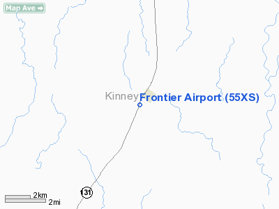
Location & QuickFacts
| FAA Information Effective: | 2008-09-25 |
| Airport Identifier: | 55XS |
| Airport Status: | Operational |
| Longitude/Latitude: | 100-25-06.2790W/29-09-58.8610N
-100.418411/29.166350 (Estimated) |
| Elevation: | 1001 ft / 305.10 m (Estimated) |
| Land: | 0 acres |
| From nearest city: | 1 nautical miles SW of Spofford, TX |
| Location: | Kinney County, TX |
| Magnetic Variation: | 08E (1995) |
Owner & Manager
| Ownership: | Privately owned |
| Owner: | Van L. Crapps |
| Address: | 5787 Cr 531
Hondo, TX 78861 |
| Phone number: | 830-426-8116 |
| Manager: | Brad Whitaker |
| Address: | Hc-61, Box 35, 367 S. Avenue C
Spofford, TX 78777 |
| Phone number: | 830-563-9779
OR 210-288-8096. |
Airport Operations and Facilities
| Airport Use: | Private |
| Wind indicator: | Yes |
| Segmented Circle: | No |
| Control Tower: | No |
| Landing fee charge: | No |
| Sectional chart: | San Antonio |
| Region: | ASW - Southwest |
| Boundary ARTCC: | ZHU - Houston |
| Tie-in FSS: | SJT - San Angelo |
| FSS on Airport: | No |
| FSS Toll Free: | 1-800-WX-BRIEF |
Airport Communications
Runway Information
Runway 01/19
| Dimension: | 4316 x 60 ft / 1315.5 x 18.3 m |
| Surface: | ASPH, |
| |
Runway 01 |
Runway 19 |
| Traffic Pattern: | Left | Right |
| Obstruction: | 350 ft tower, 7000.0 ft from runway | 350 ft tower, 3000.0 ft from runway |
|
Radio Navigation Aids
| ID |
Type |
Name |
Ch |
Freq |
Var |
Dist |
| PFO | NDB | Spofford | | 356.00 | 08E | 1.4 nm |
| BRX | NDB | La Fonda Ranch | | 269.00 | 09E | 11.1 nm |
| CPZ | NDB | Chaparrosa Ranch | | 385.00 | 10E | 26.6 nm |
| LKX | NDB | La Pryor | | 223.00 | 09E | 32.8 nm |
| UVA | NDB | Uvalde | | 281.00 | 07E | 36.4 nm |
| DMD | NDB | Dimmit County | | 343.00 | 07E | 49.7 nm |
| DLF | VORTAC | Laughlin | 091X | 114.40 | 07E | 21.9 nm |
Images and information placed above are from
http://www.airport-data.com/airport/55XS/
We thank them for the data!
| General Info
|
| Country |
United States
|
| State |
TEXAS
|
| FAA ID |
55XS
|
| Latitude |
29-09-58.861N
|
| Longitude |
100-25-06.279W
|
| Elevation |
1001 feet
|
| Near City |
SPOFFORD
|
We don't guarantee the information is fresh and accurate. The data may
be wrong or outdated.
For more up-to-date information please refer to other sources.
|
|


