 |
|
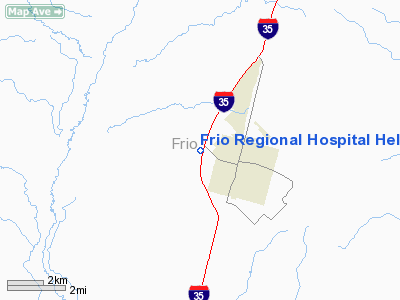
Frio Rgnl Hospital Heliport |
Location & QuickFacts
| FAA Information Effective: | 2008-09-25 |
| Airport Identifier: | TE98 |
| Airport Status: | Operational |
| Longitude/Latitude: | 099-07-02.0000W/28-53-50.0000N
-99.117222/28.897222 (Estimated) |
| Elevation: | 630 ft / 192.02 m (Estimated) |
| Land: | 0 acres |
| From nearest city: | 2 nautical miles W of Pearsall, TX |
| Location: | Frio County, TX |
| Magnetic Variation: | 07E (2000) |
Owner & Manager
| Ownership: | Privately owned |
| Owner: | Frio Regional Hospital |
| Address: | 200 S. Ih 35
Pearsall, TX 78061 |
| Phone number: | 830-334-3617 |
| Manager: | Alan Holmes, Ceo |
| Address: | 200 S. Ih 35
Pearsall, TX 78061 |
| Phone number: | 830-334-3617 |
Airport Operations and Facilities
| Airport Use: | Private
MEDICAL. |
| Wind indicator: | Yes |
| Segmented Circle: | No |
| Control Tower: | No |
| Lighting Schedule: | DUSK-DAWN |
| Sectional chart: | San Antonio |
| Region: | ASW - Southwest |
| Boundary ARTCC: | ZHU - Houston |
| Tie-in FSS: | SJT - San Angelo |
| FSS Toll Free: | 1-800-WX-BRIEF |
Runway Information
Helipad H1
| Dimension: | 48 x 48 ft / 14.6 x 14.6 m |
| Surface: | CONC, |
| |
Runway H1 |
Runway |
| Traffic Pattern: | Left | Left |
|
Radio Navigation Aids
| ID |
Type |
Name |
Ch |
Freq |
Var |
Dist |
| HHH | NDB | Devine | | 359.00 | 07E | 17.2 nm |
| HMA | NDB | Hondo | | 329.00 | 08E | 28.8 nm |
| CVB | NDB | Castroville | | 338.00 | 08E | 30.4 nm |
| PEZ | NDB | Pleasanton | | 275.00 | 07E | 31.7 nm |
| UVA | NDB | Uvalde | | 281.00 | 07E | 36.1 nm |
| LKX | NDB | La Pryor | | 223.00 | 09E | 38.9 nm |
| DMD | NDB | Dimmit County | | 343.00 | 07E | 43.7 nm |
| CPZ | NDB | Chaparrosa Ranch | | 385.00 | 10E | 46.8 nm |
| KSY | TACAN | Kelly | 057X | | 07E | 40.9 nm |
| SSF | VOR | Stinson | | 108.40 | 09E | 41.5 nm |
| HDO | VOR/DME | Hondo | 31X | 109.40 | 08E | 27.3 nm |
| COT | VORTAC | Cotulla | 105X | 115.80 | 09E | 26.2 nm |
Images and information placed above are from
http://www.airport-data.com/airport/TE98/
We thank them for the data!
| General Info
|
| Country |
United States
|
| State |
TEXAS
|
| FAA ID |
TE98
|
| Latitude |
28-53-50.000N
|
| Longitude |
099-07-02.000W
|
| Elevation |
630 feet
|
| Near City |
PEARSALL
|
We don't guarantee the information is fresh and accurate. The data may
be wrong or outdated.
For more up-to-date information please refer to other sources.
|
|


