 |
|
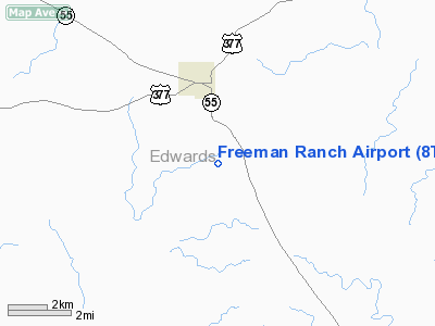
Location & QuickFacts
| FAA Information Effective: | 2008-09-25 |
| Airport Identifier: | 8TX2 |
| Airport Status: | Operational |
| Longitude/Latitude: | 100-12-06.2880W/29-58-42.7590N
-100.201747/29.978544 (Estimated) |
| Elevation: | 2380 ft / 725.42 m (Estimated) |
| Land: | 0 acres |
| From nearest city: | 2 nautical miles S of Rocksprings, TX |
| Location: | Edwards County, TX |
| Magnetic Variation: | 08E (1985) |
Owner & Manager
| Ownership: | Privately owned |
| Owner: | Harold Freeman |
| Address: | 7103 Katy Hockley Cut Off
Katy, TX 77493 |
| Phone number: | 713-371-2677 |
| Address: |
|
Airport Operations and Facilities
| Airport Use: | Private |
| Segmented Circle: | No |
| Control Tower: | No |
| Sectional chart: | San Antonio |
| Region: | ASW - Southwest |
| Boundary ARTCC: | ZHU - Houston |
| Tie-in FSS: | SJT - San Angelo |
| FSS Toll Free: | 1-800-WX-BRIEF |
Runway Information
Runway 04/22
| Dimension: | 3000 x 20 ft / 914.4 x 6.1 m |
| Surface: | GRVL,
SFC MADE OF CALICHE. |
| |
Runway 04 |
Runway 22 |
| Traffic Pattern: | Right | Left |
|
Radio Navigation Aids
| ID |
Type |
Name |
Ch |
Freq |
Var |
Dist |
| SOA | NDB | Sonora | | 371.00 | 08E | 43.0 nm |
| RSG | VORTAC | Rocksprings | 049X | 111.20 | 10E | 5.5 nm |
| JCT | VORTAC | Junction | 107X | 116.00 | 08E | 42.2 nm |
| DLF | VORTAC | Laughlin | 091X | 114.40 | 07E | 47.6 nm |
Remarks
- PRVDD ALL OPNS ARE CONDUCTED NW OF RWY.
Images and information placed above are from
http://www.airport-data.com/airport/8TX2/
We thank them for the data!
| General Info
|
| Country |
United States
|
| State |
TEXAS
|
| FAA ID |
8TX2
|
| Latitude |
29-58-42.759N
|
| Longitude |
100-12-06.288W
|
| Elevation |
2380 feet
|
| Near City |
ROCKSPRINGS
|
We don't guarantee the information is fresh and accurate. The data may
be wrong or outdated.
For more up-to-date information please refer to other sources.
|
|


