 |
|
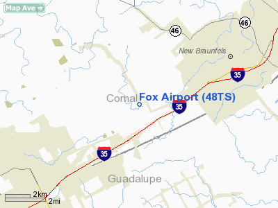
Location & QuickFacts
| FAA Information Effective: | 2008-09-25 |
| Airport Identifier: | 48TS |
| Airport Status: | Operational |
| Longitude/Latitude: | 098-11-56.0370W/29-40-03.8120N
-98.198899/29.667726 (Estimated) |
| Elevation: | 650 ft / 198.12 m (Estimated) |
| Land: | 25 acres |
| From nearest city: | 5 nautical miles NE of New Braunfels, TX |
| Location: | Comal County, TX |
| Magnetic Variation: | 08E (1980) |
Owner & Manager
| Ownership: | Privately owned |
| Owner: | Kermit W. Fox, Jr. |
| Address: | 212 Stumberg No. 210
San Antonio, TX 78204 |
| Phone number: | 512-226-9279 |
| Manager: | Kermit W. Fox, Jr. |
| Address: | 212 Stumberg No. 210
San Anotnio, TX 78204 |
| Phone number: | 512-226-9279 |
Airport Operations and Facilities
| Airport Use: | Private |
| Wind indicator: | Yes |
| Segmented Circle: | No |
| Control Tower: | No |
| Sectional chart: | San Antonio |
| Region: | ASW - Southwest |
| Boundary ARTCC: | ZHU - Houston |
| Tie-in FSS: | SJT - San Angelo |
| FSS Toll Free: | 1-800-WX-BRIEF |
Runway Information
Runway 05/23
| Dimension: | 2200 x 75 ft / 670.6 x 22.9 m |
| Surface: | TURF, |
| |
Runway 05 |
Runway 23 |
| Traffic Pattern: | Left | Left |
| Obstruction: | 40 ft trees, 50.0 ft from runway | 40 ft trees, 50.0 ft from runway |
|
Radio Navigation Aids
| ID |
Type |
Name |
Ch |
Freq |
Var |
Dist |
| CVB | NDB | Castroville | | 338.00 | 08E | 39.1 nm |
| ER | NDB | Shein | | 263.00 | 08E | 44.8 nm |
| PEZ | NDB | Pleasanton | | 275.00 | 07E | 46.0 nm |
| DHK | TACAN | Randolph | 036X | | 09E | 8.6 nm |
| KSY | TACAN | Kelly | 057X | | 07E | 26.0 nm |
| SSF | VOR | Stinson | | 108.40 | 09E | 27.7 nm |
| RND | VORTAC | Randolph | 70X | 112.30 | 09E | 10.0 nm |
| SAT | VORTAC | San Antonio | 115X | 116.80 | 08E | 13.8 nm |
| STV | VORTAC | Stonewall | 085X | 113.80 | 08E | 41.8 nm |
| SAT | VOT | San Antonio Intl | | 110.40 | | 16.3 nm |
Images and information placed above are from
http://www.airport-data.com/airport/48TS/
We thank them for the data!
| General Info
|
| Country |
United States
|
| State |
TEXAS
|
| FAA ID |
48TS
|
| Latitude |
29-40-03.812N
|
| Longitude |
098-11-56.037W
|
| Elevation |
650 feet
|
| Near City |
NEW BRAUNFELS
|
We don't guarantee the information is fresh and accurate. The data may
be wrong or outdated.
For more up-to-date information please refer to other sources.
|
|


