 |
|
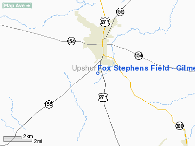
Fox Stephens Field - Gilmer Muni Airport |
Location & QuickFacts
| FAA Information Effective: | 2008-09-25 |
| Airport Identifier: | JXI |
| Airport Status: | Operational |
| Longitude/Latitude: | 094-56-55.9000W/32-41-56.4000N
-94.948861/32.699000 (Estimated) |
| Elevation: | 415 ft / 126.49 m (Surveyed) |
| Land: | 51 acres |
| From nearest city: | 2 nautical miles S of Gilmer, TX |
| Location: | Upshur County, TX |
| Magnetic Variation: | 08E (1965) |
Owner & Manager
| Ownership: | Publicly owned |
| Owner: | City Of Gilmer |
| Address: | Po Box 760
Gilmer, TX 75644 |
| Phone number: | 903-843-2552 |
| Manager: | Jeff Ellington
MIKE CATRON, AIRPORT MANAGER 903-790-7940. |
| Address: | Box 760
Gilmer, TX 75644 |
| Phone number: | 903-843-2552 |
Airport Operations and Facilities
| Airport Use: | Open to public |
| Wind indicator: | Yes |
| Segmented Circle: | Yes |
| Control Tower: | No |
| Lighting Schedule: | DUSK-DAWN |
| Beacon Color: | Clear-Green (lighted land airport) |
| Landing fee charge: | No |
| Sectional chart: | Memphis |
| Region: | ASW - Southwest |
| Boundary ARTCC: | ZFW - Fort Worth |
| Tie-in FSS: | FTW - Fort Worth |
| FSS on Airport: | No |
| FSS Phone: | 817-541-3474 |
| FSS Toll Free: | 1-800-WX-BRIEF |
| NOTAMs Facility: | JXI (NOTAM-d service avaliable) |
| Federal Agreements: | NGY |
Airport Communications
Airport Services
| Fuel available: | 100LL |
| Airframe Repair: | MAJOR |
| Power Plant Repair: | MAJOR |
| Bottled Oxygen: | NONE |
| Bulk Oxygen: | NONE |
Runway Information
Runway 18/36
| Dimension: | 4000 x 60 ft / 1219.2 x 18.3 m |
| Surface: | ASPH, Good Condition |
| Weight Limit: | Single wheel: 12000 lbs. |
| Edge Lights: | Medium |
| |
Runway 18 |
Runway 36 |
| Longitude: | 094-56-55.7500W | 094-56-55.9460W |
| Latitude: | 32-42-12.6960N | 32-41-33.1190N |
| Elevation: | 414.00 ft | 405.00 ft |
| Alignment: | 127 | 0 |
| Traffic Pattern: | Left | Left |
| Markings: | Basic, Poor Condition
RY 18 & 36 MARKINGS COMPLETELY FADED & WORN. | Basic, Poor Condition |
| Crossing Height: | 31.00 ft | 35.00 ft |
| VASI: | 2-light PAPI on left side | 2-light PAPI on left side |
| Visual Glide Angle: | 3.75° | 4.00° |
| Obstruction: | 6 ft tree, 298.0 ft from runway, 16:1 slope to clear | 35 ft trees, 1200.0 ft from runway, 28:1 slope to clear |
|
Radio Navigation Aids
| ID |
Type |
Name |
Ch |
Freq |
Var |
Dist |
| ABG | NDB | Ambassador | | 404.00 | 07E | 10.8 nm |
| LST | NDB | Lone Star | | 305.00 | 05E | 17.2 nm |
| HNO | NDB | Henderson | | 371.00 | 06E | 31.0 nm |
| TY | NDB | Tyler | | 320.00 | 06E | 31.4 nm |
| ATA | NDB | Atlanta | | 347.00 | 04E | 45.4 nm |
| RPF | NDB | Carthage | | 332.00 | 04E | 45.5 nm |
| VIV | NDB | Vivian | | 284.00 | 06E | 48.4 nm |
| UIM | VOR/DME | Quitman | 087X | 114.00 | 08E | 23.8 nm |
| TYR | VOR/DME | Tyler | 089X | 114.20 | 06E | 30.9 nm |
| SLR | VOR/DME | Sulphur Springs | 027X | 109.00 | 08E | 42.4 nm |
| FZT | VOR/DME | Frankston | 051X | 111.40 | 06E | 47.8 nm |
| GGG | VORTAC | Gregg County | 070X | 112.30 | 07E | 19.6 nm |
Remarks
Images and information placed above are from
http://www.airport-data.com/airport/JXI/
We thank them for the data!
| General Info
|
| Country |
United States
|
| State |
TEXAS
|
| FAA ID |
JXI
|
| Latitude |
32.699000
32° 41' 56.40" N
|
| Longitude |
-94.948861
094° 56' 55.90" W
|
| Elevation |
415 feet
126 meters
|
| Magnetic Variation |
003° E (01/06)
|
| Beacon |
Yes
|
| Operating Agency |
U.S.CIVIL AIRPORT WHEREIN PERMIT COVERS USE BY TRANSIT MILITARY AIRCRAFT
|
| Daylight Saving Time |
Second Sunday in March at 0200 to first Sunday in November at 0200 local time (Exception Arizona and that portion of Indiana in the Eastern Time Zone)
|
We don't guarantee the information is fresh and accurate. The data may
be wrong or outdated.
For more up-to-date information please refer to other sources.
|
|


