 |
|
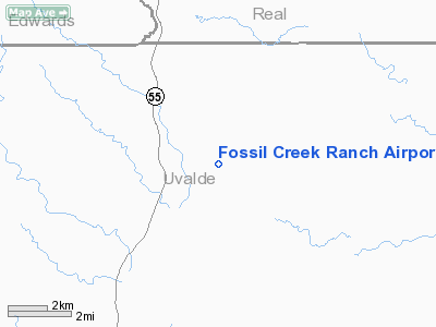
Fossil Creek Ranch Airport |
Location & QuickFacts
| FAA Information Effective: | 2008-09-25 |
| Airport Identifier: | TE78 |
| Airport Status: | Operational |
| Longitude/Latitude: | 099-58-28.2300W/29-34-07.3200N
-99.974508/29.568700 (Estimated) |
| Elevation: | 1325 ft / 403.86 m (Estimated) |
| Land: | 0 acres |
| From nearest city: | 5 nautical miles N of Camp Wood, TX |
| Location: | Uvalde County, TX |
| Magnetic Variation: | 07E (1995) |
Owner & Manager
| Ownership: | Privately owned |
| Owner: | F. Kenneth Bailey |
| Address: | 8441 Gulf Freeway Suite 600
Houston, TX 77017 |
| Phone number: | 713-230-2389 |
| Manager: | Richard Oliver |
| Address: | 8402 Nelms
Houston, TX 77061 |
| Phone number: | 713-641-0171 |
Airport Operations and Facilities
| Airport Use: | Private |
| Segmented Circle: | No |
| Control Tower: | No |
| Lighting Schedule: | PHONE REQ
FOR MIRL RY 04/22 CALL 713-230-2389. |
| Sectional chart: | San Antonio |
| Region: | ASW - Southwest |
| Boundary ARTCC: | ZHU - Houston |
| Tie-in FSS: | SJT - San Angelo |
| FSS Toll Free: | 1-800-WX-BRIEF |
Runway Information
Runway 04/22
| Dimension: | 5300 x 75 ft / 1615.4 x 22.9 m |
| Surface: | ASPH, |
| Edge Lights: | Medium |
| |
Runway 04 |
Runway 22 |
| Traffic Pattern: | Left | Left |
|
Radio Navigation Aids
| ID |
Type |
Name |
Ch |
Freq |
Var |
Dist |
| UVA | NDB | Uvalde | | 281.00 | 07E | 26.9 nm |
| PFO | NDB | Spofford | | 356.00 | 08E | 34.8 nm |
| LKX | NDB | La Pryor | | 223.00 | 09E | 38.9 nm |
| CPZ | NDB | Chaparrosa Ranch | | 385.00 | 10E | 39.6 nm |
| BRX | NDB | La Fonda Ranch | | 269.00 | 09E | 40.3 nm |
| HMA | NDB | Hondo | | 329.00 | 08E | 43.6 nm |
| HDO | VOR/DME | Hondo | 31X | 109.40 | 08E | 43.7 nm |
| RSG | VORTAC | Rocksprings | 049X | 111.20 | 10E | 31.7 nm |
| DLF | VORTAC | Laughlin | 091X | 114.40 | 07E | 43.6 nm |
| CSI | VORTAC | Center Point | 122X | 117.50 | 08E | 45.0 nm |
Images and information placed above are from
http://www.airport-data.com/airport/TE78/
We thank them for the data!
| General Info
|
| Country |
United States
|
| State |
TEXAS
|
| FAA ID |
TE78
|
| Latitude |
29-34-07.320N
|
| Longitude |
099-58-28.230W
|
| Elevation |
1325 feet
|
| Near City |
CAMP WOOD
|
We don't guarantee the information is fresh and accurate. The data may
be wrong or outdated.
For more up-to-date information please refer to other sources.
|
|


