 |
|
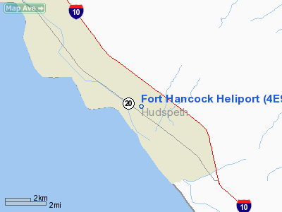
Location & QuickFacts
| FAA Information Effective: | 2008-09-25 |
| Airport Identifier: | 4E9 |
| Airport Status: | Closed Permanently |
| Longitude/Latitude: | 105-51-01.8820W/31-17-30.4510N
-105.850523/31.291792 (Estimated) |
| Elevation: | 3517 ft / 1071.98 m (Estimated) |
| Land: | 0 acres |
| From nearest city: | 1 nautical miles N of Fort Hancock, TX |
| Location: | Hudspeth County, TX |
| Magnetic Variation: | 10E (1985) |
Owner & Manager
| Ownership: | Publicly owned |
| Owner: | Hudspeth Co Civil Defense |
| Address: | Box 68
Sierra Blanca, TX 79851 |
| Phone number: | 915-369-2321 |
| Manager: | Doyle L Ziler, County Judge
HUDSPETH COUNTY JUDGE AND DIR OF CIV DEF. |
| Address: | Po Box 68,
Sierra Blanca, TX 79851 |
| Phone number: | 915-369-2321 |
Airport Operations and Facilities
| Airport Use: | Private |
| Wind indicator: | No |
| Segmented Circle: | No |
| Control Tower: | No |
| Landing fee charge: | No |
| Sectional chart: | El Paso |
| Region: | ASW - Southwest |
| Boundary ARTCC: | ZAB - Albuquerque |
| Tie-in FSS: | ABQ - Albuquerque |
| FSS on Airport: | No |
| FSS Toll Free: | 1-800-WX-BRIEF |
Airport Services
| Airframe Repair: | NONE |
| Power Plant Repair: | NONE |
Runway Information
Helipad H1
| Dimension: | 90 x 90 ft / 27.4 x 27.4 m |
| Surface: | DIRT, |
| |
Runway H1 |
Runway |
| Traffic Pattern: | Left | Left |
|
Radio Navigation Aids
| ID |
Type |
Name |
Ch |
Freq |
Var |
Dist |
| EL | NDB | Valtr | | 242.00 | 11E | 41.7 nm |
| CJS | VOR/DME | Ciudad Juarez | 114X | 116.70 | 11E | 36.1 nm |
| HUP | VORTAC | Hudspeth | 097X | 115.00 | 12E | 29.5 nm |
| ELP | VORTAC | El Paso | 099X | 115.20 | 12E | 38.5 nm |
| EWM | VORTAC | Newman | 071X | 112.40 | 12E | 45.2 nm |
| SFL | VORTAC | Salt Flat | 077X | 113.00 | 12E | 47.8 nm |
| ELP | VOT | El Paso Intl | | 111.00 | | 41.4 nm |
Remarks
- INTENDED USE OF HELIPORT IS TO PROVIDE AIR AMBULANCE SVC THRU THE MAST /MIL ASST TO SAFETY AND TFC/ PROGRAM.
- (ARPT STATUS) ARPT CLSD PERMLY.
Images and information placed above are from
http://www.airport-data.com/airport/4E9/
We thank them for the data!
| General Info
|
| Country |
United States
|
| State |
TEXAS
|
| FAA ID |
4E9
|
| Latitude |
31-17-30.451N
|
| Longitude |
105-51-01.882W
|
| Elevation |
3517 feet
|
| Near City |
FORT HANCOCK
|
We don't guarantee the information is fresh and accurate. The data may
be wrong or outdated.
For more up-to-date information please refer to other sources.
|
|


