 |
|
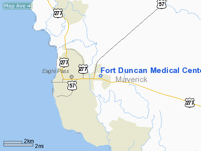
Fort Duncan Medical Center Heliport |
Location & QuickFacts
| FAA Information Effective: | 2008-09-25 |
| Airport Identifier: | 0XA2 |
| Airport Status: | Operational |
| Longitude/Latitude: | 100-27-24.6700W/28-42-43.6200N
-100.456853/28.712117 (Estimated) |
| Elevation: | 884 ft / 269.44 m (Estimated) |
| Land: | 0 acres |
| From nearest city: | 3 nautical miles W of Eagle Pass, TX |
| Location: | Maverick County, TX |
| Magnetic Variation: | () |
Owner & Manager
| Ownership: | Privately owned |
| Owner: | Fort Duncan Medical Center |
| Address: | 3172 Megan St
Eagle Pass, TX 78852 |
| Phone number: | 830-773-5321 |
| Manager: | Fort Duncan Medical Center |
| Address: | 3172 Megan St
Eagle Pass, TX 78852 |
| Phone number: | 830-773-5321 |
Airport Operations and Facilities
| Airport Use: | Private
MEDICAL. |
| Wind indicator: | Yes |
| Control Tower: | No |
| Lighting Schedule: | DUSK-DAWN |
| Sectional chart: | San Antonio |
| Region: | ASW - Southwest |
| Boundary ARTCC: | ZHU - Houston |
| Tie-in FSS: | SJT - San Angelo |
| FSS Toll Free: | 1-800-WX-BRIEF |
Runway Information
Helipad H1
| Dimension: | 40 x 40 ft / 12.2 x 12.2 m |
| Surface: | CONC, |
| |
Runway H1 |
Runway |
| Traffic Pattern: | Left | Left |
|
Radio Navigation Aids
| ID |
Type |
Name |
Ch |
Freq |
Var |
Dist |
| PFO | NDB | Spofford | | 356.00 | 08E | 26.1 nm |
| CPZ | NDB | Chaparrosa Ranch | | 385.00 | 10E | 26.6 nm |
| BRX | NDB | La Fonda Ranch | | 269.00 | 09E | 31.1 nm |
| LKX | NDB | La Pryor | | 223.00 | 09E | 34.3 nm |
| DMD | NDB | Dimmit County | | 343.00 | 07E | 35.1 nm |
| UVA | NDB | Uvalde | | 281.00 | 07E | 47.6 nm |
| DLF | VORTAC | Laughlin | 091X | 114.40 | 07E | 42.4 nm |
Images and information placed above are from
http://www.airport-data.com/airport/0XA2/
We thank them for the data!
|
|


