 |
|
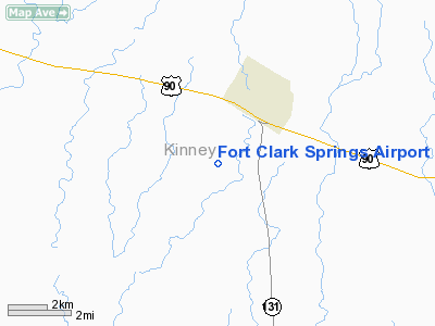
Fort Clark Springs Airport |
Location & QuickFacts
| FAA Information Effective: | 2008-09-25 |
| Airport Identifier: | 74TX |
| Airport Status: | Operational |
| Longitude/Latitude: | 100-26-01.2820W/29-17-11.8470N
-100.433689/29.286624 (Estimated) |
| Elevation: | 1106 ft / 337.11 m (Surveyed) |
| Land: | 200 acres |
| From nearest city: | 2 nautical miles SW of Brackettville, TX |
| Location: | Kinney County, TX |
| Magnetic Variation: | 08E (1985) |
Owner & Manager
| Ownership: | Privately owned |
| Owner: | Ft Clark Springs Assn |
| Address: | Po Box 345
Brackettville, TX 78832 |
| Manager: | Elward A. Rogers |
| Address: | Po Box 345
Brackettville, TX 78832 |
| Phone number: | 512-563-2493 |
Airport Operations and Facilities
| Airport Use: | Private |
| Wind indicator: | Yes |
| Segmented Circle: | No |
| Control Tower: | No |
| Landing fee charge: | No |
| Sectional chart: | San Antonio |
| Region: | ASW - Southwest |
| Boundary ARTCC: | ZHU - Houston |
| Tie-in FSS: | SJT - San Angelo |
| FSS on Airport: | No |
| FSS Toll Free: | 1-800-WX-BRIEF |
Airport Communications
Runway Information
Runway 15/33
| Dimension: | 4170 x 200 ft / 1271.0 x 61.0 m |
| Surface: | TURF, |
| |
Runway 15 |
Runway 33 |
| Traffic Pattern: | Left | Left |
|
Runway 17/35
| Dimension: | 5500 x 200 ft / 1676.4 x 61.0 m |
| Surface: | TURF, |
| |
Runway 17 |
Runway 35 |
| Traffic Pattern: | Left | Left |
|
Radio Navigation Aids
| ID |
Type |
Name |
Ch |
Freq |
Var |
Dist |
| PFO | NDB | Spofford | | 356.00 | 08E | 8.5 nm |
| BRX | NDB | La Fonda Ranch | | 269.00 | 09E | 11.0 nm |
| CPZ | NDB | Chaparrosa Ranch | | 385.00 | 10E | 31.9 nm |
| LKX | NDB | La Pryor | | 223.00 | 09E | 37.2 nm |
| UVA | NDB | Uvalde | | 281.00 | 07E | 37.7 nm |
| DLF | VORTAC | Laughlin | 091X | 114.40 | 07E | 18.3 nm |
| RSG | VORTAC | Rocksprings | 049X | 111.20 | 10E | 44.3 nm |
Remarks
Images and information placed above are from
http://www.airport-data.com/airport/74TX/
We thank them for the data!
| General Info
|
| Country |
United States
|
| State |
TEXAS
|
| FAA ID |
74TX
|
| Latitude |
29-17-11.847N
|
| Longitude |
100-26-01.282W
|
| Elevation |
1106 feet
|
| Near City |
BRACKETTVILLE
|
We don't guarantee the information is fresh and accurate. The data may
be wrong or outdated.
For more up-to-date information please refer to other sources.
|
|


