 |
|
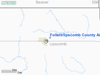
Follett/lipscomb County Airport |
Location & QuickFacts
| FAA Information Effective: | 2008-09-25 |
| Airport Identifier: | T93 |
| Airport Status: | Operational |
| Longitude/Latitude: | 100-07-25.7710W/36-26-26.9250N
-100.123825/36.440812 (Estimated) |
| Elevation: | 2601 ft / 792.78 m (Surveyed) |
| Land: | 60 acres |
| From nearest city: | 1 nautical miles E of Follett, TX |
| Location: | Lipscomb County, TX |
| Magnetic Variation: | 09E (1980) |
Owner & Manager
| Ownership: | Publicly owned |
| Owner: | City Of Follett |
| Address: | Box 216
Follett, TX 79034 |
| Phone number: | 806-653-2601 |
| Manager: | Robert Williamson
CITY MANAGER. |
| Address: | Box 216
Follet, TX 79034 |
| Phone number: | 806-653-2601 |
Airport Operations and Facilities
| Airport Use: | Open to public |
| Wind indicator: | Yes
LIGHTS OTS INDEFLY. |
| Segmented Circle: | Yes |
| Control Tower: | No |
| Lighting Schedule: | DUSK-DAWN |
| Landing fee charge: | No |
| Sectional chart: | Wichita |
| Region: | ASW - Southwest |
| Traffic Pattern Alt: | 1000 ft |
| Boundary ARTCC: | ZKC - Kansas City |
| Tie-in FSS: | FTW - Fort Worth |
| FSS on Airport: | No |
| FSS Phone: | 817-541-3474 |
| FSS Toll Free: | 1-800-WX-BRIEF |
| NOTAMs Facility: | FTW (NOTAM-d service avaliable) |
Airport Communications
Airport Services
| Bottled Oxygen: | NONE |
| Bulk Oxygen: | NONE |
Runway Information
Runway 17/35
| Dimension: | 4073 x 60 ft / 1241.5 x 18.3 m |
| Surface: | ASPH, Poor Condition
13 FT WIDE STRIP OF PAVEMENT ALONG WEST EDGE OF RY IS SPONGY AND WILL NOT SUPPORT LISTED WHEEL WEIGHT. |
| Weight Limit: | Single wheel: 18000 lbs. |
| Edge Lights: | Low |
| |
Runway 17 |
Runway 35 |
| Longitude: | 100-07-25.8050W | 100-07-25.6630W |
| Latitude: | 36-26-47.0300N | 36-26-06.7700N |
| Elevation: | 2532.00 ft | 2601.00 ft |
| Alignment: | 127 | 127 |
| Traffic Pattern: | Left | Left |
| Markings: | Non-precision instrument, Poor Condition
RY MARKINGS FADED. | Non-precision instrument, Poor Condition
RY MARKINGS FADED. |
| Obstruction: | 10 ft pline, 685.0 ft from runway, 240 ft right of centerline, 48:1 slope to clear | 18 ft hill, 800.0 ft from runway, 33:1 slope to clear |
|
Radio Navigation Aids
| ID |
Type |
Name |
Ch |
Freq |
Var |
Dist |
| OWU | NDB | West Woodward | | 329.00 | 08E | 29.0 nm |
| PYX | NDB | Perryton | | 266.00 | 09E | 30.2 nm |
| BFK | NDB | Buffalo | | 215.00 | 08E | 35.2 nm |
| HHF | NDB | Hemphill County | | 400.00 | 08E | 35.8 nm |
| MDF | NDB | Mooreland/dcmsnd | | 284.00 | 08E | 45.1 nm |
| GAG | VORTAC | Gage | 103X | 115.60 | 10E | 13.2 nm |
Remarks
- NO LINE OF SIGHT BTN RY ENDS.
Images and information placed above are from
http://www.airport-data.com/airport/T93/
We thank them for the data!
| General Info
|
| Country |
United States
|
| State |
TEXAS
|
| FAA ID |
T93
|
| Latitude |
36-26-26.925N
|
| Longitude |
100-07-25.771W
|
| Elevation |
2601 feet
|
| Near City |
FOLLETT
|
We don't guarantee the information is fresh and accurate. The data may
be wrong or outdated.
For more up-to-date information please refer to other sources.
|
|


