 |
|
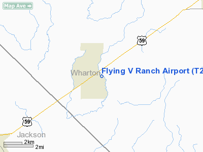
Location & QuickFacts
| FAA Information Effective: | 2008-09-25 |
| Airport Identifier: | T26 |
| Airport Status: | Operational |
| Longitude/Latitude: | 096-23-55.6000W/29-06-29.8000N
-96.398778/29.108278 (Estimated) |
| Elevation: | 60 ft / 18.29 m (Estimated) |
| Land: | 10 acres |
| From nearest city: | 1 nautical miles SE of Louise, TX |
| Location: | Wharton County, TX |
| Magnetic Variation: | 06E (1995) |
Owner & Manager
| Ownership: | Privately owned |
| Owner: | Robert C Vajdos, Jr. |
| Address: | Po Box 367
Louise, TX 77455 |
| Phone number: | 979-648-2163 |
| Manager: | Robbie Vajdos |
| Address: | Po Box 367
Louise, TX 77455 |
| Phone number: | 979-648-2163 |
Airport Operations and Facilities
| Airport Use: | Open to public |
| Wind indicator: | Yes |
| Segmented Circle: | No |
| Control Tower: | No |
| Sectional chart: | Houston |
| Region: | ASW - Southwest |
| Boundary ARTCC: | ZHU - Houston |
| Tie-in FSS: | CXO - Montgomery County |
| FSS on Airport: | No |
| FSS Toll Free: | 1-800-WX-BRIEF |
| NOTAMs Facility: | CXO (NOTAM-d service avaliable) |
Airport Communications
| CTAF: | 122.800 |
| Unicom: | 122.800 |
Airport Services
Runway Information
Runway 14/32
| Dimension: | 2990 x 80 ft / 911.4 x 24.4 m |
| Surface: | TURF, Good Condition |
| |
Runway 14 |
Runway 32 |
| Traffic Pattern: | Left | Right |
| Obstruction: | 35 ft tree, 55 ft right of centerline | 35 ft tree, 90.0 ft from runway, 90 ft right of centerline, 2:1 slope to clear |
|
Radio Navigation Aids
| ID |
Type |
Name |
Ch |
Freq |
Var |
Dist |
| ARM | NDB | Wharton | | 245.00 | 06E | 15.7 nm |
| BYY | NDB | Bay City | | 344.00 | 06E | 29.5 nm |
| PKV | NDB | Port Lavaca | | 515.00 | 05E | 31.3 nm |
| OKT | NDB | Yoakum | | 350.00 | 06E | 40.7 nm |
| VCT | VOR/DME | Victoria | 027X | 109.00 | 06E | 33.0 nm |
| ELA | VOR/DME | Eagle Lake | 111X | 116.40 | 08E | 33.6 nm |
| PSX | VORTAC | Palacios | 120X | 117.30 | 08E | 21.2 nm |
Images and information placed above are from
http://www.airport-data.com/airport/T26/
We thank them for the data!
| General Info
|
| Country |
United States
|
| State |
TEXAS
|
| FAA ID |
T26
|
| Latitude |
29-06-29.800N
|
| Longitude |
096-23-55.600W
|
| Elevation |
60 feet
|
| Near City |
LOUISE
|
We don't guarantee the information is fresh and accurate. The data may
be wrong or outdated.
For more up-to-date information please refer to other sources.
|
|


