 |
|
Location & QuickFacts
| FAA Information Effective: | 2008-09-25 |
| Airport Identifier: | TA08 |
| Airport Status: | Operational |
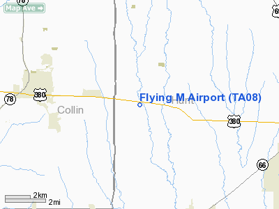
| Longitude/Latitude: | 096-16-25.9240W/33-08-58.4170N
-96.273868/33.149560 (Estimated) |
| Elevation: | 585 ft / 178.31 m (Estimated) |
| Land: | 0 acres |
| From nearest city: | 2 nautical miles W of Floyd, TX |
| Location: | Hunt County, TX |
| Magnetic Variation: | 06E (1985) |
Owner & Manager
| Ownership: | Privately owned |
| Owner: | Lawrence G. Molck |
| Address: | 510 Maple Street
Farmersville, TX 75442 |
| Phone number: | 214-782-8620 |
| Address: |
|
Airport Operations and Facilities
| Airport Use: | Private |
| Wind indicator: | No |
| Segmented Circle: | No |
| Control Tower: | No |
| Landing fee charge: | No |
| Sectional chart: | Dallas-ft Worth |
| Region: | ASW - Southwest |
| Boundary ARTCC: | ZFW - Fort Worth |
| Tie-in FSS: | FTW - Fort Worth |
| FSS on Airport: | No |
| FSS Phone: | 817-541-3474 |
| FSS Toll Free: | 1-800-WX-BRIEF |
Runway Information
Runway 18/36
| Dimension: | 1950 x 50 ft / 594.4 x 15.2 m |
| Surface: | TURF, |
| |
Runway 18 |
Runway 36 |
| Traffic Pattern: | Left | Left |
|
Radio Navigation Aids
| ID |
Type |
Name |
Ch |
Freq |
Var |
Dist |
| MII | NDB | Caddo Mills | | 316.00 | 06E | 6.7 nm |
| SYW | NDB | Cash | | 428.00 | 05E | 14.5 nm |
| AVZ | NDB | Travis | | 260.00 | 06E | 23.4 nm |
| PQF | NDB | Mesquite | | 248.00 | 06E | 24.2 nm |
| HJM | NDB | Rayburn | | 415.00 | 06E | 28.3 nm |
| JUG | NDB | Jecca | | 388.00 | 06E | 31.7 nm |
| LNC | NDB | Lancaster | | 239.00 | 06E | 41.1 nm |
| RBD | NDB | Redbird | | 287.00 | 06E | 41.4 nm |
| DNI | NDB | Denison | | 341.00 | 06E | 45.1 nm |
| DUA | NDB | Durant | | 359.00 | 05E | 48.1 nm |
| XQH | NDB | Cedar Hill | | 353.00 | 08E | 48.8 nm |
| MJF | TACAN | Arvilla | 033X | | 05E | 11.8 nm |
| CVE | VOR/DME | Cowboy | 109X | 116.20 | 06E | 35.4 nm |
| SLR | VOR/DME | Sulphur Springs | 027X | 109.00 | 08E | 36.9 nm |
| TTT | VOR/DME | Maverick | 078X | 113.10 | 06E | 42.2 nm |
| PRX | VOR/DME | Paris | 083X | 113.60 | 07E | 47.7 nm |
| URH | VOR/DME | Texoma | 090X | 114.30 | 05E | 48.1 nm |
| UIM | VOR/DME | Quitman | 087X | 114.00 | 08E | 48.5 nm |
| BYP | VORTAC | Bonham | 093X | 114.60 | 06E | 23.4 nm |
| FUZ | VORTAC | Ranger | 104X | 115.70 | 06E | 48.2 nm |
| DAL | VOT | Dallas Love Field | | 113.30 | | 34.3 nm |
Remarks
- CONDL PRVDD THR ON NORTH END DSPLCD TO PRVD 20:1 CLNC OVER THE ROADWAY.
Images and information placed above are from
http://www.airport-data.com/airport/TA08/
We thank them for the data!
| General Info
|
| Country |
United States
|
| State |
TEXAS
|
| FAA ID |
TA08
|
| Latitude |
33-08-58.417N
|
| Longitude |
096-16-25.924W
|
| Elevation |
585 feet
|
| Near City |
FLOYD
|
We don't guarantee the information is fresh and accurate. The data may
be wrong or outdated.
For more up-to-date information please refer to other sources.
|
|


