 |
|
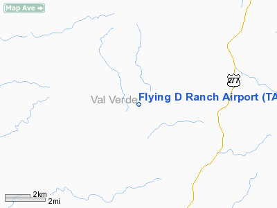
Location & QuickFacts
| FAA Information Effective: | 2008-09-25 |
| Airport Identifier: | TA29 |
| Airport Status: | Operational |
| Longitude/Latitude: | 100-50-24.3580W/29-55-32.7490N
-100.840099/29.925764 (Estimated) |
| Elevation: | 1630 ft / 496.82 m (Surveyed) |
| Land: | 4 acres |
| From nearest city: | 34 nautical miles N of Del Rio, TX |
| Location: | Val Verde County, TX |
| Magnetic Variation: | 08E (1985) |
Owner & Manager
| Ownership: | Privately owned |
| Owner: | E A Davis |
| Address: | Po Box 326
Smiley, TX 78159-0326 |
| Phone number: | 210-587-6381 |
| Manager: | E A Davis |
| Address: | Box 326
Smiley, TX 78159-0326 |
| Phone number: | 210-587-6381
ALSO 210-395-2233. |
Airport Operations and Facilities
| Airport Use: | Private |
| Wind indicator: | Yes |
| Segmented Circle: | No |
| Control Tower: | No |
| Landing fee charge: | No |
| Sectional chart: | San Antonio |
| Region: | ASW - Southwest |
| Boundary ARTCC: | ZHU - Houston |
| Tie-in FSS: | SJT - San Angelo |
| FSS on Airport: | No |
| FSS Toll Free: | 1-800-WX-BRIEF |
Runway Information
Runway 01/19
| Dimension: | 1960 x 50 ft / 597.4 x 15.2 m
VARIES IN WIDTH FROM 50 - 100'. |
| Surface: | TURF, Poor Condition
+3 FT BRUSH ALONG FULL LENGTH OF RY; +3 FT WEEDS AND GRASS ON RY. |
| |
Runway 01 |
Runway 19 |
| Traffic Pattern: | Left | Left |
| Obstruction: | 15 ft brush | 25 ft hngr, 0.0 ft from runway, 90 ft left of centerline |
|
Radio Navigation Aids
| ID |
Type |
Name |
Ch |
Freq |
Var |
Dist |
| SOA | NDB | Sonora | | 371.00 | 08E | 40.7 nm |
| BRX | NDB | La Fonda Ranch | | 269.00 | 09E | 44.6 nm |
| RSG | VORTAC | Rocksprings | 049X | 111.20 | 10E | 28.6 nm |
| DLF | VORTAC | Laughlin | 091X | 114.40 | 07E | 34.1 nm |
Remarks
- RWY 01/19 SURROUNDED BY +200' - 400' HILLS WITHIN 0.5 MILE.
- CATTLE ON & INVOF RY.
- MAY BE EXEMPT UNDER GRANDFATHER CLAUSE.
Images and information placed above are from
http://www.airport-data.com/airport/TA29/
We thank them for the data!
| General Info
|
| Country |
United States
|
| State |
TEXAS
|
| FAA ID |
TA29
|
| Latitude |
29-55-32.749N
|
| Longitude |
100-50-24.358W
|
| Elevation |
1630 feet
|
| Near City |
DEL RIO
|
We don't guarantee the information is fresh and accurate. The data may
be wrong or outdated.
For more up-to-date information please refer to other sources.
|
|


