 |
|
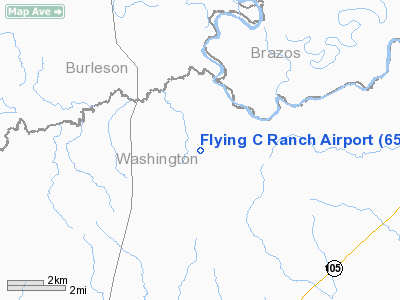
Location & QuickFacts
| FAA Information Effective: | 2008-09-25 |
| Airport Identifier: | 65TA |
| Airport Status: | Operational |
| Longitude/Latitude: | 096-18-25.8650W/30-20-35.7530N
-96.307185/30.343265 (Estimated) |
| Elevation: | 250 ft / 76.20 m (Estimated) |
| Land: | 0 acres |
| From nearest city: | 3 nautical miles NE of Independence, TX |
| Location: | Washington County, TX |
| Magnetic Variation: | 06E (1985) |
Owner & Manager
| Ownership: | Privately owned |
| Owner: | Joel M. Cummings |
| Address: | Rt 2, Box 552
Brenham, TX 77833 |
| Phone number: | 409-836-8110 |
| Manager: | Joel Cummings |
| Address: | Rt 2 Box 552
Brenham, TX 77833 |
| Phone number: | 409-836-8110 |
Airport Operations and Facilities
| Airport Use: | Private |
| Wind indicator: | Yes |
| Segmented Circle: | No |
| Control Tower: | No |
| Landing fee charge: | No |
| Sectional chart: | Houston |
| Region: | ASW - Southwest |
| Boundary ARTCC: | ZHU - Houston |
| Tie-in FSS: | CXO - Montgomery County |
| FSS on Airport: | No |
| FSS Toll Free: | 1-800-WX-BRIEF |
Runway Information
Runway 16/34
| Dimension: | 2600 x 30 ft / 792.5 x 9.1 m |
| Surface: | ASPH, |
| |
Runway 16 |
Runway 34 |
| Traffic Pattern: | Left | Left |
| Obstruction: | 50 ft trees, 450.0 ft from runway | |
|
Radio Navigation Aids
| ID |
Type |
Name |
Ch |
Freq |
Var |
Dist |
| BNH | NDB | Brenham | | 362.00 | 06E | 8.0 nm |
| GYB | NDB | Lee County | | 385.00 | 07E | 36.4 nm |
| DWH | NDB | David Hooks | | 521.00 | 05E | 40.7 nm |
| EYQ | NDB | Weiser | | 286.00 | 06E | 42.5 nm |
| UTS | NDB | Huntsville | | 308.00 | 06E | 44.1 nm |
| LYD | NDB | Lakeside | | 249.00 | 05E | 45.6 nm |
| ELA | VOR/DME | Eagle Lake | 111X | 116.40 | 08E | 40.9 nm |
| TNV | VORTAC | Navasota | 106X | 115.90 | 08E | 13.3 nm |
| CLL | VORTAC | College Station | 080X | 113.30 | 08E | 16.8 nm |
| IDU | VORTAC | Industry | 039X | 110.20 | 08E | 26.8 nm |
Images and information placed above are from
http://www.airport-data.com/airport/65TA/
We thank them for the data!
| General Info
|
| Country |
United States
|
| State |
TEXAS
|
| FAA ID |
XS25
|
| Latitude |
29-23-04.870N
|
| Longitude |
095-40-58.811W
|
| Elevation |
70 feet
|
| Near City |
NEEDVILLE
|
We don't guarantee the information is fresh and accurate. The data may
be wrong or outdated.
For more up-to-date information please refer to other sources.
|
|


