 |
|
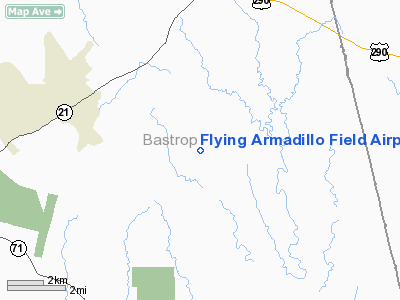
Flying Armadillo Field Airport |
Location & QuickFacts
| FAA Information Effective: | 2008-09-25 |
| Airport Identifier: | 1XA5 |
| Airport Status: | Operational |
| Longitude/Latitude: | 097-08-34.5000W/30-08-06.0600N
-97.142917/30.135017 (Estimated) |
| Elevation: | 410 ft / 124.97 m (Estimated) |
| Land: | 8 acres |
| From nearest city: | 10 nautical miles S of Paige, TX |
| Location: | Bastrop County, TX |
| Magnetic Variation: | () |
Owner & Manager
| Ownership: | Privately owned |
| Owner: | Michael & Peggy Reeser |
| Address: | 1276 Old Pin Oak Rd
Paige, TX 78659 |
| Phone number: | 512-253-2433 |
| Manager: | Michael Reeser |
| Address: | 1276 Old Pin Oak Rd
Paige, TX 78659 |
| Phone number: | 512-253-2433 |
Airport Operations and Facilities
| Airport Use: | Private |
| Wind indicator: | Yes |
| Control Tower: | No |
| Sectional chart: | San Antonio |
| Region: | ASW - Southwest |
| Boundary ARTCC: | ZHU - Houston |
| Tie-in FSS: | SJT - San Angelo |
| FSS Toll Free: | 1-800-WX-BRIEF |
Runway Information
Runway 08/26
| Dimension: | 2500 x 100 ft / 762.0 x 30.5 m |
| Surface: | TURF, |
| |
Runway 08 |
Runway 26 |
| Traffic Pattern: | Left | Left |
|
Radio Navigation Aids
| ID |
Type |
Name |
Ch |
Freq |
Var |
Dist |
| GYB | NDB | Lee County | | 385.00 | 07E | 8.8 nm |
| BNH | NDB | Brenham | | 362.00 | 06E | 40.3 nm |
| GUO | NDB | Georgetown | | 332.00 | 06E | 43.2 nm |
| OKT | NDB | Yoakum | | 350.00 | 06E | 49.5 nm |
| CWK | VORTAC | Centex | 075X | 112.80 | 06E | 24.9 nm |
| IDU | VORTAC | Industry | 039X | 110.20 | 08E | 32.1 nm |
| CLL | VORTAC | College Station | 080X | 113.30 | 08E | 46.9 nm |
Remarks
Images and information placed above are from
http://www.airport-data.com/airport/1XA5/
We thank them for the data!
|
|


