 |
|
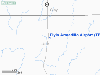
Location & QuickFacts
| FAA Information Effective: | 2008-09-25 |
| Airport Identifier: | TE55 |
| Airport Status: | Operational |
| Longitude/Latitude: | 098-11-26.0000W/33-25-18.0000N
-98.190556/33.421667 (Estimated) |
| Elevation: | 995 ft / 303.28 m (Estimated) |
| Land: | 12 acres |
| From nearest city: | 14 nautical miles N of Jacksboro, TX |
| Location: | Jack County, TX |
| Magnetic Variation: | 07E (1995) |
Owner & Manager
| Ownership: | Privately owned |
| Owner: | Kevin R Berry |
| Address: | Rt 2 Box 283
Bowie, TX 76230 |
| Phone number: | 940-476-2670 |
| Manager: | Kevin R Berry |
| Address: | Rt 2 Box 283
Bowie, TX 76230 |
| Phone number: | 940-476-2670 |
Airport Operations and Facilities
| Airport Use: | Private |
| Wind indicator: | Yes |
| Segmented Circle: | No |
| Control Tower: | No |
| Lighting Schedule: | RDO-CTL
ACTVT MIRL RY 07/25 - 122.8. |
| Sectional chart: | Dallas-ft Worth |
| Region: | ASW - Southwest |
| Boundary ARTCC: | ZFW - Fort Worth |
| Tie-in FSS: | FTW - Fort Worth |
| FSS Phone: | 817-541-3474 |
| FSS Toll Free: | 1-800-WX-BRIEF |
Airport Communications
Runway Information
Runway 07/25
| Dimension: | 3000 x 100 ft / 914.4 x 30.5 m |
| Surface: | TURF, |
| Edge Lights: | Medium |
| |
Runway 07 |
Runway 25 |
| Traffic Pattern: | Left | Left |
| Obstruction: | | 250 ft tower, 2100.0 ft from runway |
|
Radio Navigation Aids
| ID |
Type |
Name |
Ch |
Freq |
Var |
Dist |
| GHX | NDB | Graham | | 371.00 | 07E | 21.7 nm |
| GMZ | NDB | Grindstone Mountain | | 356.00 | 07E | 23.6 nm |
| SKB | NDB | Scotland | | 344.00 | 08E | 26.6 nm |
| GZV | NDB | Brazos River | | 280.00 | 07E | 30.4 nm |
| ONY | NDB | Olney | | 272.00 | 07E | 31.7 nm |
| MWL | NDB | Mineral Wells | | 266.00 | 06E | 38.8 nm |
| SHP | TACAN | Sheppard | 045X | | 10E | 36.8 nm |
| UKW | VORTAC | Bowie | 071X | 112.40 | 06E | 19.7 nm |
| SPS | VORTAC | Wichita Falls | 074X | 112.70 | 10E | 39.5 nm |
| MQP | VORTAC | Millsap | 124X | 117.70 | 09E | 42.9 nm |
Images and information placed above are from
http://www.airport-data.com/airport/TE55/
We thank them for the data!
| General Info
|
| Country |
United States
|
| State |
TEXAS
|
| FAA ID |
TE55
|
| Latitude |
33-25-24.000N
|
| Longitude |
098-11-56.000W
|
| Elevation |
985 feet
|
| Near City |
JACKSBORO
|
We don't guarantee the information is fresh and accurate. The data may
be wrong or outdated.
For more up-to-date information please refer to other sources.
|
|


